Notes for travellers in Western Australian Kimberley on landscapes near Talbot Bay.
The ‘Kimberley Landscapes’ post introduces many of the names and process mentioned in this article. Readers may find it a useful supplement to other articles about the Kimberley coast.
This post could also be read in association with that on the ‘Talbot Creek’.
In these articles I generally refrain from describing the magnificence of the local landforms but give a broad outline of the formation of the landscapes and a little of their natural history in the hope that these explanations may remove some of the bewilderment about how such natural, often complex wonders originated.
The Horizontal Waterfalls
Overview
The Horizontal Waterfalls (HW) are found in the south western corner of Talbot Bay a deep bay located on the north side Yampi Peninsula east of Koolan Island. Rather than horizontal rock formations this corner of the Kimberley is made up of well folded formations and in the vicinity of the HW folds were so steep to be nearly perpendicular (Fig. 1). This meant that the local rock formations including the Wunaamin Miliwundi Sandstone, Carson Volcanics, Warton Sandstone, Elgee Siltstone and Pentecost Sandstone that were originally horizontal and over 4 km deep were folded, in parallel, to stand vertically.

What happened to make today’s phenomenon?
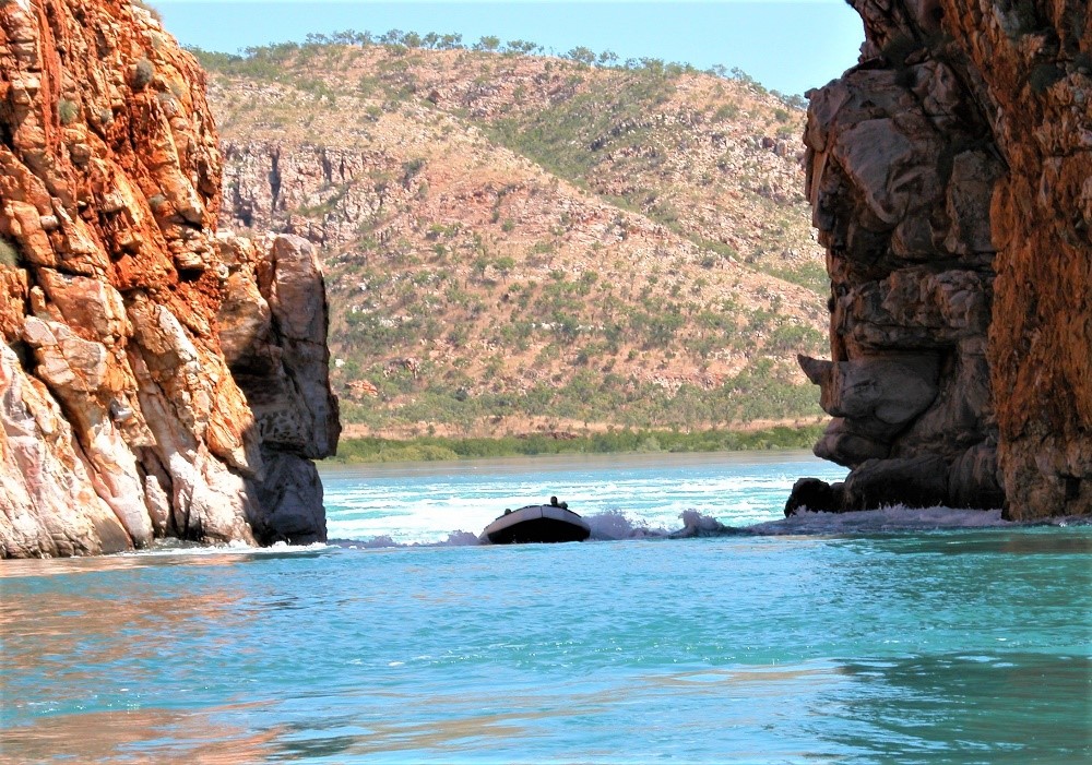
Today the set of landforms at the HW (Fig. 2) are made up of three ridges (#3, #5 and &7), two with gaps (#10 and #12) through them and two embayments (#11 and #13). The embayment are flooded valleys between the three ridges. Tidal water from Talbot Bay (#1) may flood in through the outer gap to fill the first embayment and as it rises forces water through the second gap to fill the inner embayment. As the tide falls, the flow is reversed and the level of water in the embayment drops again. In brief it is the narrow gaps and the high tidal ranges in Talbot Bay that creates the waterfall-like flow.

The high hills and deep valleys resulting from folding through past orogenic (mountain building) activity would then have been subjected to weathering and erosion (Fig.3 #1). Once the tops of the high points were removed each of the five formations would have been exposed end-on. As illustrated on the right hand side of Fig.3, the three sandstone formations (#9) would be least affected and weathered at a relatively slow rate to remain as ridges. However, the Carson Volcanics (#3) is less resistant due to its basaltic composition and has been chemically weathered. The Elgee Siltstone (#5), because of its physical weakness, would have been easily removed by running water. Most of this weathering and erosion occurred during times of lower sea level and the base the Volcanics and Siltstone is currently well below the low tide mark (#10 and #11), hence they are continually flooded and form today’s embayments.

The two gaps (Fig. 1) are likely to have formed as creek water escaping from the higher landforms cut down through joints in the Warton Sandstone and the Pentecost Sandstone. These creeks would also have carried away any products of weathering. The inner embayment deepened because of the rapid chemical weathering of Carson Volcanics and it is possible today to find remnants of basalt on the sides of this embayment (Fig.2 #6). The outer embayment represents the space where Elgee Siltstone once stood but because of its susceptibility to physical weathering by running water it too has been lowered well below current sea level. Like the Carson Volcanics remnants of the siltstone also remain on the embayment walls (Fig.4 ; Fig. 2 #4). The outer ridge is formed from Pentecost Sandstone, the middle ridge from Warton Sandstone and the inner wall, without a gap is formed from Wunaamin Miliwundi Sandstone.

The section of the coast outside Talbot Bay is subject to maco-tidal conditions (greater and a 4 m range) and as the tidal influence moves deeper into the Bay it tends to intensify. As the high tide water builds the narrow gaps resist the flow the water, it builds up on the outer side and has to run ‘down hill’ into the first embayment (Fig. 5). This creates one horizontal waterfall that is repeated at the second gap. These flows are all reversed with the outgoing tide and between these tides there are short periods of slack water.

Boating operators taking passengers through the Horizontal Waterfalls are required to observe safe practice given the ferocity with which the water moves especially during Spring Tide events of the lunar month as occurs over the full moon and new moon periods.
Sea levels reached their current level some 6,000 year ago and prior to this the tidal flow would have progressively moved further out of Talbot Bay and eventually at the peak of the last Ice Age, 18,000 to 20,000 years ago, seas were some 120 m lower than today. Given the very wide continental shelf in this part of Australia the shoreline then would have been 100 km seaward. At this stage we could imagine that Poulton Creek (Fig. 2 #16) which runs into the inner embayment would have flowed as a stream out through the two gaps, possibly fallen over a waterfall into Talbot Bay where it joined Talbot Creek out of the bay and across the continental shelf to the sea.
We must conclude that in Geological Time this is a very recent event and although the current conditions may be adding to the weathering and erosion, these were not what led to the initial development of this somewhat unique set of landforms.


