Eucalypt Bark – Background Briefing

Bark variation as seen with Eucalyptus and closely related species

Eucalypt in the common name for well over 700 species of low shrubs to giant trees mainly growing in Australia with about 100 species overseas. Within Australia they are widely distributed, make up a large proportion of species in forests and woodlands and occupy a variety of habitats ranging from high rainfall areas through to arid zones.

The name eucalypt includes the genus Eucalyptus, and often includes several other genera including the close relative Corymbia and more distant groups like Angophora. All these genera are included in Family Myrtaceae. This article will be concentrating on bark features of Eucalyptus.

When we make a preliminary identification of a Eucalyptus species there are a number of distinguishing features including its habit (the form of the tree, shrub or mallee), its bark type (smooth or one of the rough bark types) shape and size of the juvenile and adult leaves, the arrangement of the leaves and their colour. However, for a firmer identification of the species you are likely to need the flower buds to see their shape and how they are clustered, the flower and some of the woody fruits. The use of these diagnostic features is beyond the scope of this article that concentrates of features of Eucalypt bark.

Two members of the Myrtaceae from the east Kimberley, a box Eucalyptus sp. (left) and a Corymbia sp (right).

Bark types

Bark is the outer protective layer of stem tissue in wood plants, it is formed of corky tissue which is dead tissue that overlies active the living tissue essential for growth and as the plants conductive tissue. These latter tissues overly the central woody tissue which is dead.

The outer layers of bark provide us with characteristics that allows us to subdivide eucalypts into smooth bark or rough barked species.  The type of bark was often used as the main identifying feature of people involved with forestry and saw milling.

Smooth bark species often called gums, may have plain white, copper or salmon coloured bark or spotted colours; bark with scribbly like marks; with small flakes of shedded bark or cascaded with ribbon bark, shed from smooth bark above.

 Note that the name gum tree is commonly used when referring to all eucalypts but more technically the term only applies to those with smooth bark. Well known gums include salmon gum Eucalyptus salmonophloia, snow gum E.pauciflora and Sydney blue gum E. saligna, a species with generally smooth bark but often with rough bark is persistent at trunk base.

E. grandis, flooded gum planted is a wet fern gully, Mt Lofty, Botanic Garden, SA. It has a smooth upper trunk and a fibrous or flaky base with. E.grandis often reach 50m high and with ideal growing conditions may reach 8m.

Karri (E. diversicolor) are the giant gum trees of southwest Western Australia and as their specific epithet diversicolor suggests, they have a varying colour range including whitish grey to reddish grey. In E. viminalis commonly known as manna gum or ribbon gum, bark is shed in long ribbons that my hang in lower branches

A gum tree shedding its bark as ribbons. Possibly E.viminalis. Wet forest community, Noosa, QLD.

River red gum (E camaldulensis) Bulloo River near Thargomindah, southwest Queensland. August, 2022. This gum has the widest Eucalypt distribution in Australia, and it is common along most inland watercourses except those in SW Western Australia. It may also be found in the grassy woodlands such as the Western Volcanic Plains in Victoria.
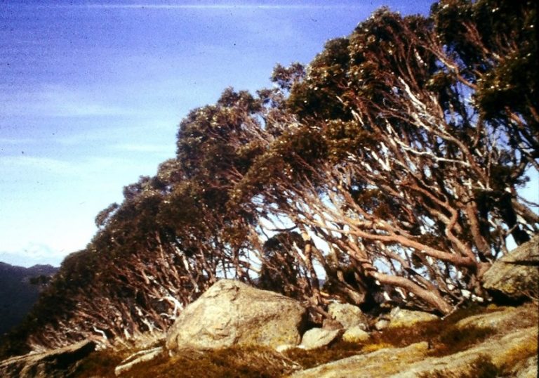
A ridge populated with snow gum (E. pauciflora). Near Thredbo, Kosciuszko, NSW National Park
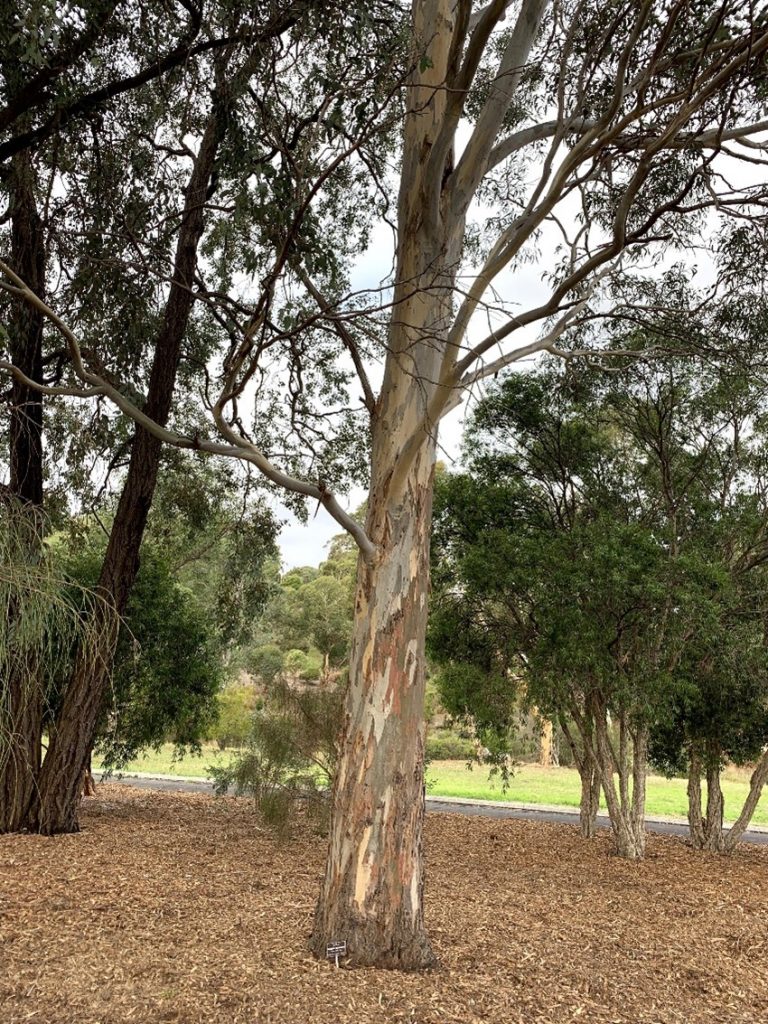
River red gum E.camaldulensis planted in Wittunga Botanic Garden, SA

In rough barks, the outer bark is not necessarily shed from the stem/trunk as thin layers but builds up as dead tissue and only the very outer layers fall away. These barks contain varying amounts of lignin, tannins and kino complex chemical materials that binds this outer bark. The added chemicals determine the colour and strength to the bark fibres..

When eucalypts have interlocking bark fibres bound together but that may be pulled off as long thick pieces they are described as stringybarks or mahoganies.  Red stringybark E. macrorhycha occurs in southern eastern Australia has grey to reddish brown on the trunk and branches. Some stringybarks, like E.nicholli, are also called a peppermints attributed to the smell of the oil released when its leaves are crushed.

 Narrow leafed black peppermint, E. nicholii . Planted in Wittunga Botanic Garden, SA

A group of Darwin woollybutts (E.miniata) box barked trees with their lower trunk covered with rough fibrous bark but the upper section is smooth like a gum. Northwest Kimberley, Western Australia.

E.nicholii, is a box. This term used to describe trees with a fibrous bark but the fibres are not long enough to be removed a long strings.  Darwin woollybutt, E. miniata is a box that grows across much of northern Australia and may be distinguished by its bark from its regular companion species E. tetrodonta, commonly known as Darwin stringybark.  Yellow box, E. melliodora is so named because in some trees the bark has a yellowish colour but in main the fibrous outer bark is grey to red-brown.

E.tesselaris a box with tessellated bark, Stanley Island, Flinders Group National Park, Great Barrier Reef.

E. macrocarpa (Green leafed or grey box) left and Murray box (E. largiflorens) right. Both planted in Wittunga Botanic Gardens, SA.

Both planted in Wittunga Botanic Gardens, SA.

When the tissue is heavily impregnated with kino and the outer dead fibres may become very hard, thick and furrowed. This is typical in eucalypts called ironbarks. With mugga ironbark, E. sideroxylon, for example, the trunk bark is dark brown to black but the leading branchlets may be smooth and white.
Two ironbark species E. calyei and E. sideroxyon. Caley’s iron bark (left) and mugga ironbark (right), planted in Wittunga Botanic Gardens Adelaide, SA

E. sideroxylon, mugga ironbark, Wittunga Botanic Garden, SA

Plant Habit

Habit is defined for eucalypts as the general appearance or characteristic growth-form of a plant. Most of the examples used in this article relates to Eucalypt trees. However, several of the Eucalypt species mentioned may also develop in the mallee form under the right conditions and may look like shrubs. Mallees are defined as multi stemmed eucalypt shrub with multiple stems arising from a woody swelling called a lignotuber. The stems(branches) of mallee arise from regenerative buds of the lignotuber and in a tall mallee may reach height (8m) equivalent to a small tree.
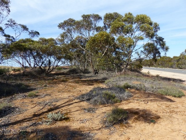
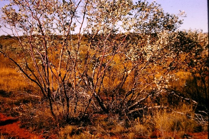
Tall mallee growing in the western Riverina, NSW (L) and a smaller species, blue mallee (R) from arid central Australia.

Trees and shrubs are both woody plants with the main difference in the field being their height. Trees are over eight metres and are composed of a trunk that is generally free of branches This main part of the trunk may be referred to as the bole and above the bole is a canopy made up of branches and their leaves. Trees that tend to grow in woodlands have a bole that is generally shorter than the depth of the canopy. In forests the bole is the longest component.
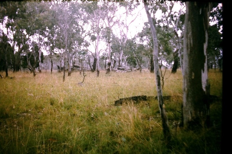
Eucalypt woodland, Ebor NSW (L) Eucalypt open forest southern edge of Pilliga National Park, NSW (R).
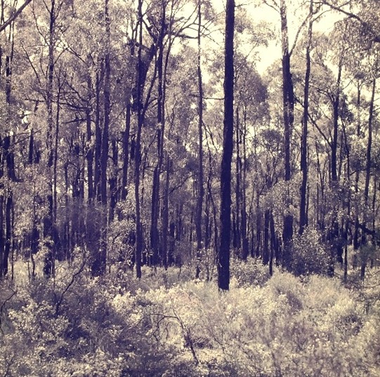
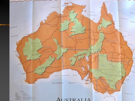
The canopy of forest species is flatter than the rounded canopy of a woodland. The canopy of a forest is said to be closed when less than 80% of the sun light reaches the ground and so they are called closed eucalypt forests. Open eucalypt forests have between 50% and 80% canopy cover and with woodland trees are more widely spaced and there is 20% to 50% crown cover. From the attached map (below) it is quite evident that the gradation from closed eucalypt forest through to eucalypt woodlands fairly closely parallels the annual rainfall totals that decrease as we move inland.

Woodland gums in grazing paddock approximately 35km west of Penola SA.
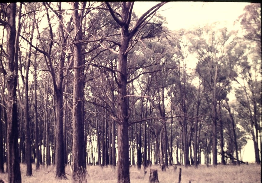
Tall eucalypt stringybark woodland South West of Saumarez’, Armidale NSW (L) Eucalypt forest at Dwellingup, WA (R).
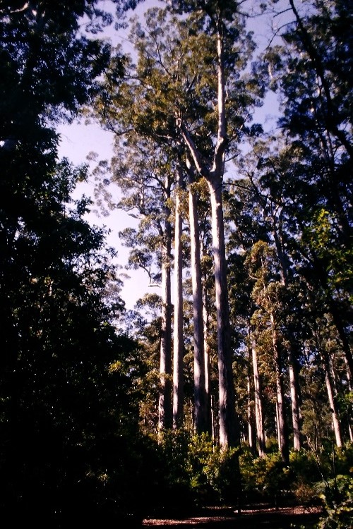
The base of a giant eucalypt, with a girth of at least 12m at chest height on the edge of a patch of closed/tall eucalypt forest, high rainfall area, central east Tasmania.

Bark extracts and uses by Australia’s First Nations people.

Extracts from bark include tannins which are used the leather tanning industry and several other ‘medicines’ have been extracted and used by First Nations people. Three of their medicinal properties are bark extracts that acted as an astringent, anti-inflammatory or antiseptic. The 1980s Australian Bicentennial Aboriginal Pharmacopoeia details these and other medicinal drugs extracted from eucalypt bark.

Sheets of bark was also used to make shelters and such shelters are referred to as a gunyah and worley. Large sheets (eg 3.1m x 0.45m) were used to make watercraft formed into a canoe shape with the forward and aft sealed by stitching and the use of clay.  The scars of the removal, mostly on now aging river red gums (E. camaldulensis) have often grown over the full outline, but the canoe shape may be easily seen.
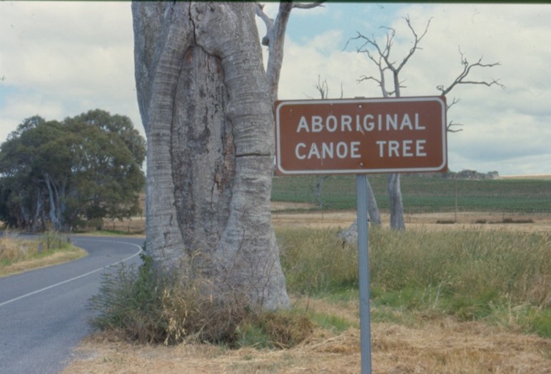
One of the many Aboriginal created ‘canoe trees’ most often seen on old, often dead E. camaldulensis. South eastern SA.

Sheets of bark removed from E. tetrodonta, a northern Australian stringybark, served in place of canvas, paper or stone as a painting surface for several First Nations people. The freshly cut curved and damp sheets cut from stringybark trees was held over a fire to help in the drying and flattening process. The sheet is then laid flat, weight down with heavy stones then used for painting once the inner surface is dry and flat. Bark painting has been common in land especially among the Yolngu of Arnhem Land since the 1930s especially so by clans-people from Yirrkala and Milingimbi.  Artwork in this medium is recognised as fine art and may be acquired at several centres in Arnhem Land such as at the large cultural centre in Maningrida.

Trunk growth and bark

The girth of a tree and other woody plants grows outwards as a response to growth in the cambium layer, a tissue made up of reproducing cells found beneath the bark. Associated with division the cells become specialised as tissue that becomes the bark, tissue that conducts organic nutrients (phloem), or tissue that conducts water from the roots (xylem). As the tree trunk expands the outer bark which is dead may be shed and is replaced by cambium as it produces the inner bark, along with the other specialised tissues. The more central tissue of wood is expanded as a new ring of dead xylem fibres is added.

Growth rings are formed from a band of new wood produced under the bark each growing season and this easily examined in a sawn off trunk or stump, or via a core drilled through the trunk of a standing tree.
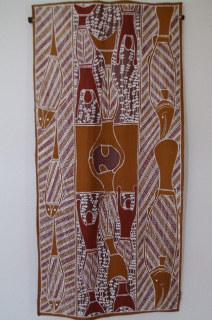
This 40 cmx 90 cm bark painting on bark by Nicholas Pascoe (Burarra language; Ji Malawa location), was purchased at the Maningrida Arts and Culture around 2000. The story in the painting is related to inland environments.
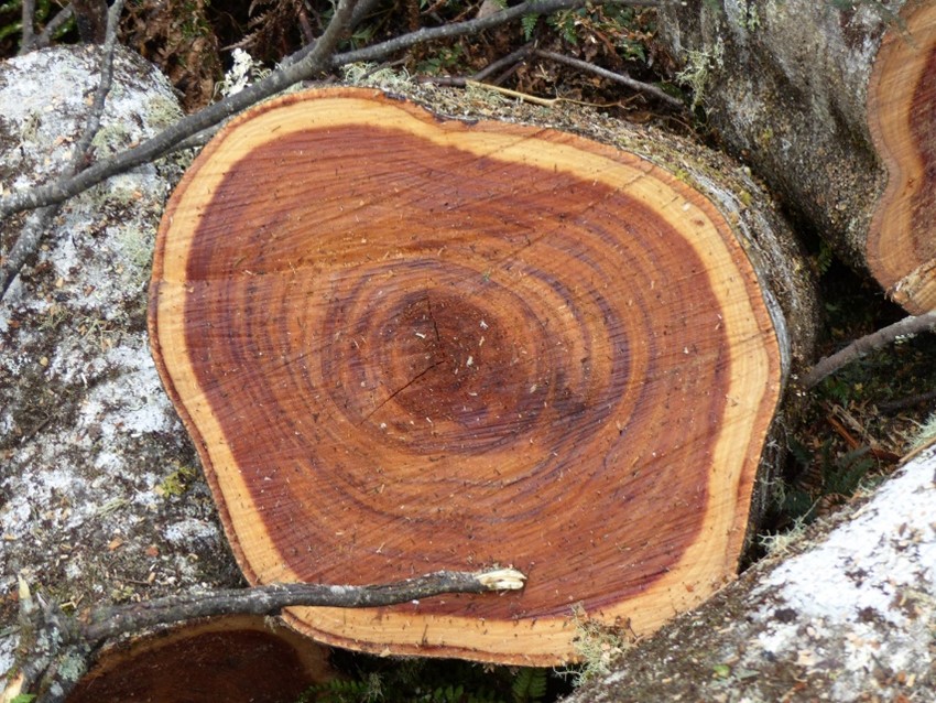
A freshly cut non eucalypt log (Sassafras ?) showing growth rings The lighter red coloured wood is from the rapid growth season, usually the wettest and warmest, the darker lines are from slow growth in the winter. Combined light plus dark equals an annual ring. Note light band outside the dark heartwood will gradually become stained as the expansion of the girth continues. Cool temperate rainforest, Tarkine, NW Tasmania.

Trees growth follows a fairly regular seasonal climate pattern, as usually occurs outside Australia in say north America and Europe.

Dendrochronologists, people who study the growth rings of tree trunks, may give a reasonably accurate estimate of a tree trunks age by counting the annual growth rings. However, for most parts of Australia climates are quite variable and this is reflected in the growth and the irregularity of the tree ring pattern.  

In most of Australia the age of most eucalypts may not be assessed by studying their growth rings. However, snow gum (E pauciflora) from say the Snowy Mountains do produce fairly definitive annual growth rings, but the river red gum (E. camaldulensis) growing on a riverbank in western New South Wales do not.

It appears that species growing in the higher cooler parts of Australia and parts of Tasmania tend to produce annual rings. A sample from a Huon pine (Lagarostrobus franklinii) from Mt Read in Tasmania has been estimated at 3,600 years old using annual ring data. By determining the width of growth rings, it also possible for dendrochronologists to interpret to environmental conditions during the period of formation.

Damage to the bark may be deep enough to destroy the cambium and phloem in particular. Injuries such as that caused by wood eating insects or an axe may be severe and lead to death of the tree especially when trees are purposefully ring barked with removal of a complete band of bark. Ring barking was commonly employed as a tree killing exercise in land clearing by pioneer farmers.

When there is only partial damage to bark e.g. a fallen branch or wind damage, cambium become active and produces growth around the damaged edges. This overgrowth is also a reaction when say old fencing wire is left tight around a tree or as happened in the past when explorers and surveyors left axed marks on trees. Over time bark covers the point of damage and these marks are hard to distinguish.

Eucalypts growing on undulating and steep country tend to collect dead leaves and fallen branches on their uphill side.  With this increased fuel, bush fires in such a community will burn more severely on the upside of a tree and burn more deeply. Trees growth reacts with growth around the burnt edge so producing an inverted V-shaped scars often on uphill side of eucalypt tree trunks.

A typical eucalypt fire scar on Blakeley’s red gum (E.blakelyi ?), Pilliga National Park, W NSW.

The scars may be deep enough to hollow out the base of the trunk so forming a shelter place or, as is the case in case in The Budj Bim Cultural Landscape in south western Victoria, the hollow was used by the local Gunditjmara clan as a smokehouse for curing kooyang, the short-finned eel. 
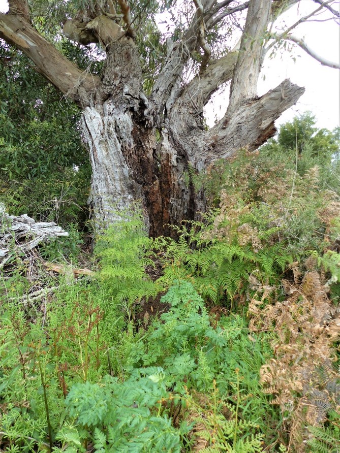
A fire scar in an old manna gum, E. viminalis. A park guide in Budj Bim Cultural Landscape suggested that this was one of the tree hollows used as a smokehouse for smoke-curing short -finned eel from their fish traps.

Mangroves Background Briefings for Travellers in Australia

Mangroves are a most common shrubs or trees especially near the coastal waterways in the tropics and sub-tropics, but mangrove species become less frequent in southern parts of the mainland and are not part of the Tasmanian floral makeup. As a group they have an interesting name, arise from a mixture for plant families and because of the habitats in which they grow have several unique features. Following are illustrated features of mangroves with the majority of images from the Kimberley coast, Western Australia (W.A.), supported with others from the Northern Territory (N.T.), Queensland (QLD.), New South Wales (N.S.W.) and South Australia (S.A.).

The word mangrove

The interesting point about the name mangrove is that it refers to both individual species that live in a particular habitat as well as the communities they form. In broad terms there are 41 different mangrove plant species found in Australia and their shrub and tree forms are all limited to tidally influenced habitats with most of these being in the tropical and sub-tropical bays, coastal lakes and river estuaries. Occasionally readers may come across the word mangal, this is a less commonly used alternative name for a mangrove community.

Two images of mangrove communities, mangals -Three-Ways off Doubtful Bay (above) and Hunter River, Kimberley W.A. (right)

Botanical descriptions such a eucalypt, wattle or saltbush, refer to groups of species in Australia in three particular plant families ,respectively, Myrtaceae with about 700 eucalypt species, Mimosaceae with 980 wattles species and Chenopodiaceae with 60 saltbush species. Australian mangroves however belong in 19 diverse families that have one or more species that has adapted to grow within the mangrove habitat. The Rhizophoraceae family is the largest and includes three genera, Rhizophora (stilt mangroves), Ceriops (yellow mangroves) and Bruguiera (orange mangroves), each being represented by several species. At the other extreme Osbornia octodonta (myrtle mangrove) and Excoecaria agallocha (milky mangroves) are represented by just a single genus and single species and belong respectively in families Myrtaceae and Euphorbiaceae

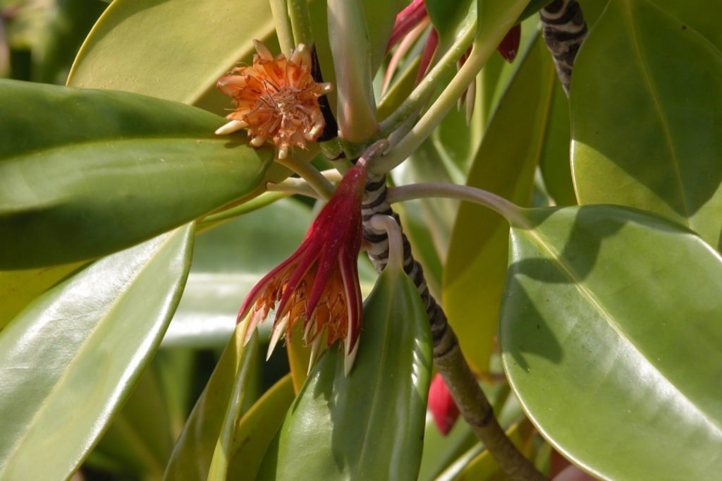
Flowering and post flowering Bruguiera gymnorhiza, large-leafed orange mangrove, showing red flowers the multiple calyx lobes. Raragala Island, Wessel Islands N.T.

Flowers of Bruguiera sp. (above) after the petals and stamens have fallen with >7-15 calyx lobes and Rhizophera sp. (right) with woolly petals has just 4 calyx lobes. Jack Barnes Bicentennial Mangrove Boardwalk south of airport terminal, Cairns, QLD.

Sonneratia alba (white-flowered apple mangrove) with its white petals and prominent white stamens. Embayment 8km south Winyalkan Island, Montague Sound, Kimberley W.A. This species is pollinated at night by flying foxes and moths. In Australia there are three species of Sonneratia in family Sonneratiaceae.

The value of mangroves

Given that mangroves occupy tidally influenced waters and are associated with estuary river flats and sheltered bays they may become less pleasing to look at as a community at low tide than when flooded. Such sites were in the recent past often considered to be smelly (explained later) unattractive lowlands.  Particularly in well populated Australian locations, such sites were often ’developed’ using landfill like sand and soil then used for ‘better’ waterside purposes such as parklands, housing estates with canals and factory building sites. In most cases planners and developers have seen the error their ways as the positive ecological values of the tidal flats and mangroves become widely known and accepted.

Ecologically, mangrove communities are extremely significant and a study in Darwin Harbour, cited by Norman Duke in Australia’s Mangroves, identified 9 species of bats, at least 11 other mammal species, 128 species of birds, and around 3000 species of invertebrates e.g. insects and spiders, all living as mangrove canopy dwellers. Aquatic fauna and organisms in the mud as sampled in the Darwin Harbour study found 36 species of crustaceans and 31 mollusc (shell fish) species associated with mangroves.

Crustaceans like crabs are most important since many they take large quantities of leaf material below the ground to be used as food.  And as most recreational and commercial fishers are aware many fish species in their juvenile stage live within the mangroves.

(Above) Indo Pacific crocodiles (Crocodylus porosus) of all sizes make use of the mangroves as they do here in Porosus Creek off Hunter River, Kimberley W.A.

Colonies of Black flying fox or fruit bat (Pteropus alecto) roost during daylight hours in mangroves -Red Cone Creek, off Doubtful Bay, Kimberley W.A.

The rarely seen chestnut rail (Eulabeornis castaneoventris). This species follows the tidal pattern rather than day and night for its foraging times on exposed soil under the mangroves. Prince Regent River, Kimberley, W.A.

Low tide exposed mangrove mud flats are favoured by mudskippers (Periophthmodon freyenineti) -Porosus Creek off Hunter River, Kimberley W.A

Mud-whelks like these mangrove snails (Telescopium telescopium) are found feeding on organic debris -Tranquil Bay, off Koolama Bay, Kimberley W.A. These species were also collected as a food source by Indigenous people.

The white flowers of the apple mangrove (Sonneratia alba) are night time food for pollinators such as flying foxes and bats.

A brahminy kite (Milvus indus) nest bult in the forks of an apple mangrove tree (Sonneratia alba), Rankin Island, Collier Bay Kimberley W.A.

Molluscs and fish as a food source, found withing mangroves, have been utilised by Indigenous people. Species of the Teredo worm that live in dead mangrove stems and trunks are also sought for food and medicinal purposes. The wood of some mangroves was used for making spears and boomerangs and naturally straight buoyant trunks of Camptostemon schultzii (kapok mangrove) was favoured in the Kimberley to make raft like watercraft.

To make rafts Worrorran people used trunks of kapok mangrove (Camptestemon schultzii) -seen at low tide in Porosus Creek off Hunter River, Kimberley W.A.

One of many middens accumulated as ‘kitchen waste’ on the creek-side off a bay south of Winyalkan Island, Kimberley W.A. Shell includes species from collected by ancestors of the Wunambal people both in tidal creeks and around mangrove roots.

Some characteristics of mangrove habitats.

Saturated soils  Mangroves mostly live in soil that is regularly saturated. This means that all the pore space in the soil is filled with water and not the mixture of air and water as is the case for most other plant communities. With all the air replaced with water, anoxic (Oxygen free) conditions exist under-ground and mangroves have developed alternate appendages to overcome the problem of no soil Oxygen.  Possibly the most obvious of these adaptations are the long, looping aerial roots as seen in stilt mangroves species in the genus Rhizophora. The stilt roots have many lenticels over their surface allowing for gaseous exchange -oxygen in and water and carbon dioxide out. Lenticels are small pores, occurring as raised sections formed by cells with lots of intercellular space.

1.Banks of the Liverpool River, Arnhem Land N.T.

2.Margaret Bay, North East QLD.

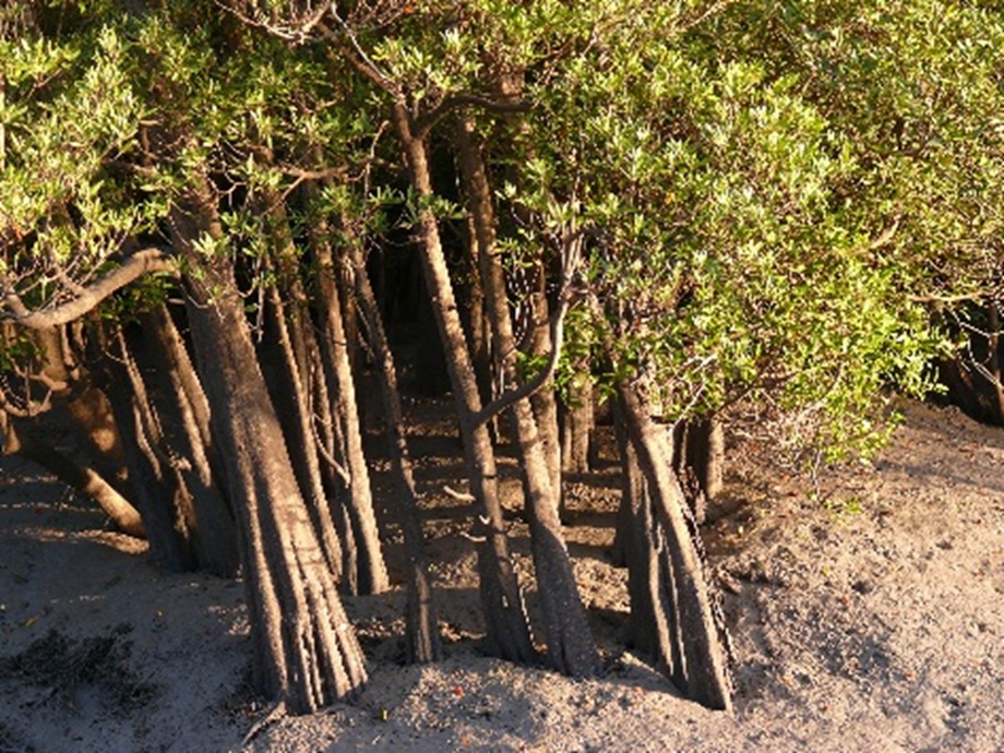
(Above) Two examples of arching prop roots of long-style stilt mangrove (Rhizophora stylosa).

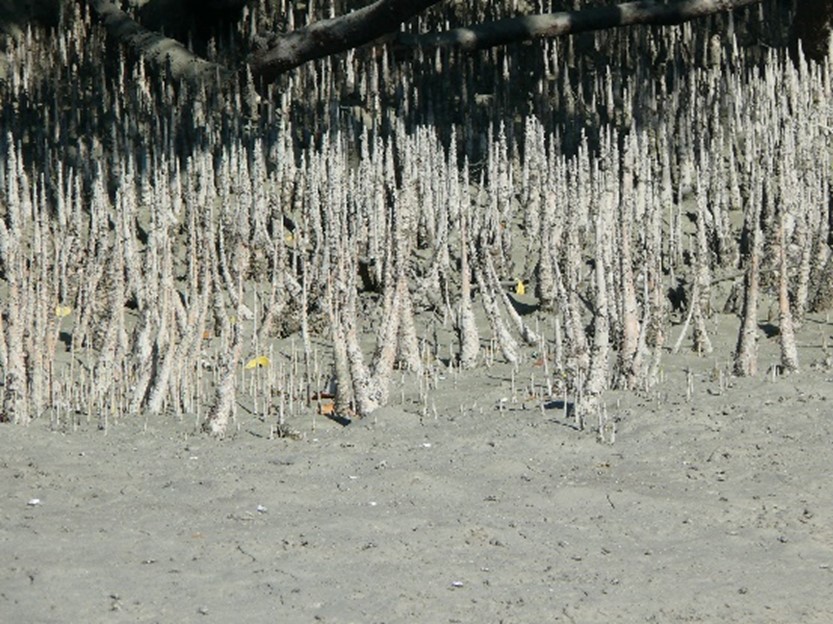
Pneumatophores are another adaptation of the root system They too are covered with lenticels and grow up above the soil level that is exposed with dropping tides. These grow up from cable roots that run out horizontally from the base of the plant as seen with grey mangrove (Avicennia marina). In this species pneumatophores are pencil shaped and generally less than 30 cm tall. With apple mangrove (Sonneratia alba) pneumatophores are more robust and cone shaped.

Pencil shaped pneumatophores on grey and white mangrove (Avicennia marina) under low tidal conditions. Prince Regent River, Kimberley, W.A.

1.Porosus Creek, Kimberley W.A.

2. Prior Point basin, Kimberley W.A.

(Above) Two examples of the sharp triangular pneumatophores of apple mangrove (Sonneratia alba).

Other adaptations are knee roots where the plant forms tight loops in roots the rise above the ground surface, while other species have lenticel covered buttress shape roots formed at the base of their stem or trunk.

Swollen, fluted, woody stem base of club mangrove (Aegialitis annulata), on the side of a tidal saltpan. This species has roots growing near the soil surface and this site is only flooded for 2 or 3 days each 14 days during spring tides. Anjo Peninsula, east Vansittart Bay, Kimberley W.A.

Knee roots sticking up through the mangrove mud. Jack Barnes Bicentennial Mangrove Boardwalk south of airport terminal, Cairns, QLD.

Break down of organic matter  Bacteria are important organisms in the decomposition of soil organic matter such as chewed up fallen mangrove leaves that have been taken underground in mangrove systems by crabs. In the anoxic (oxygen depleted) environment of saturated soils, aerobic (oxygen requiring) bacteria cannot function and are replaced by species with an alternate form of cellular respiration.

In aerobic organisms (including ourselves) respiratory energy production during cellular processes relies on a food source like carbohydrates and Oxygen.  Following a complicated set of enzyme-mediated chemical steps energy from the breakdown of carbohydrate is released along with Carbon Dioxide and water. Hydrogen is produced during the chemical breakdown and the cellular enzymes combine the Hydrogen with Oxygen to form the water.

In a summary:      Carbohydrate + Oxygen            →         energy release + carbon dioxide + water

In anoxic conditions anaerobic bacteria take over the respiratory process to breakdown carbohydrates (from chewed up leaves) but they have enzymes that substitute Sulphur not Oxygen to combine with the Hydrogen. In this case, Hydrogen Sulphide, H2S or rotten egg gas, rather than water H2O, is produced.

In a summary:   Carbohydrate + Sulphur        →     energy release + carbon dioxide + hydrogen sulphide

When soil is disturbed in mangrove habitats, we often get a whiff of the Hydrogen Sulphide! Alternatively, as the tide rises, water entering the crab holes or cracks in the soil. may push out the smelly gas H2S.

The influence of tides  Most Australian mangroves have a habitat that is flooded at least once daily and many parts of the coast, with semi-diurnal tides, are flooded twice a day. Interestingly the range between low to high tide levels varies from day to day and so we have spring and neap tides.

Spring tides are a response to full moon and new moons while neaps fall between these two lunar phases. In summary during there are two spring tides and two neap tides each 29.5 days.  During spring tides, as opposed to neap tides, the range between high and low tide increases. Shorter plants growing close to the water’s edge are therefore completely immersed in saline water by high tide on most days and it is the only the inner, landward margin of the mangal that is flooded during spring tides.

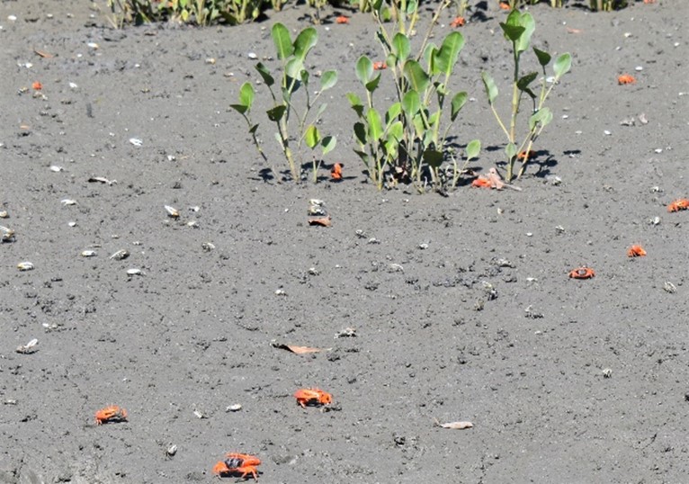
Seedlings of an unidentified mangrove species at low tide on the banks of Porosus Creek (off Hunter River, Kimberley WA) -but are they within a suitable habitat to survive as mature plants? Note the Flame Fiddler crabs in the foreground.

Whereas close to the open water plants may be flooded on more than 45 events per the 28 day lunar cycle, this reduces dramatically to less than 20 on the upland margin.  Plants in the intermediate area will be flooded by normal high tides at a frequency between these two extremes. 

River mangrove (Aegiceras corniculatum) with multiple inflorescences each consisting of immature flower buds -this species often forms a sub canopy and borders intermediate-upstream estuary magins

In practical terms the soil surfaces in mid to lower tide are flushed with water during the ebb and flow of tides but soils above this on the landward upland margin of the mangal are only wet during the highest of the spring tide. Soils on these upland margins tend to become more saline and they accumulate salt following evaporation of the water once the tides have receded. In effect, the surface dries as the water is evaporated leaving the salt.

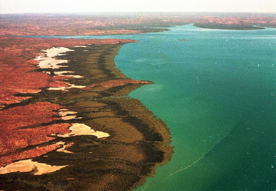
These differences in exposure to tidal flooding and salinity influence where particular mangrove species are able to grow so that plants of the same species are not randomly distributed but, in response to their habitat preferences, grow together. An aerial photo of a mangrove lined shore demonstrates this phenomenon with similar species forming bands of similar leaf texture, height and colour generally occurring parallel to the shoreline.

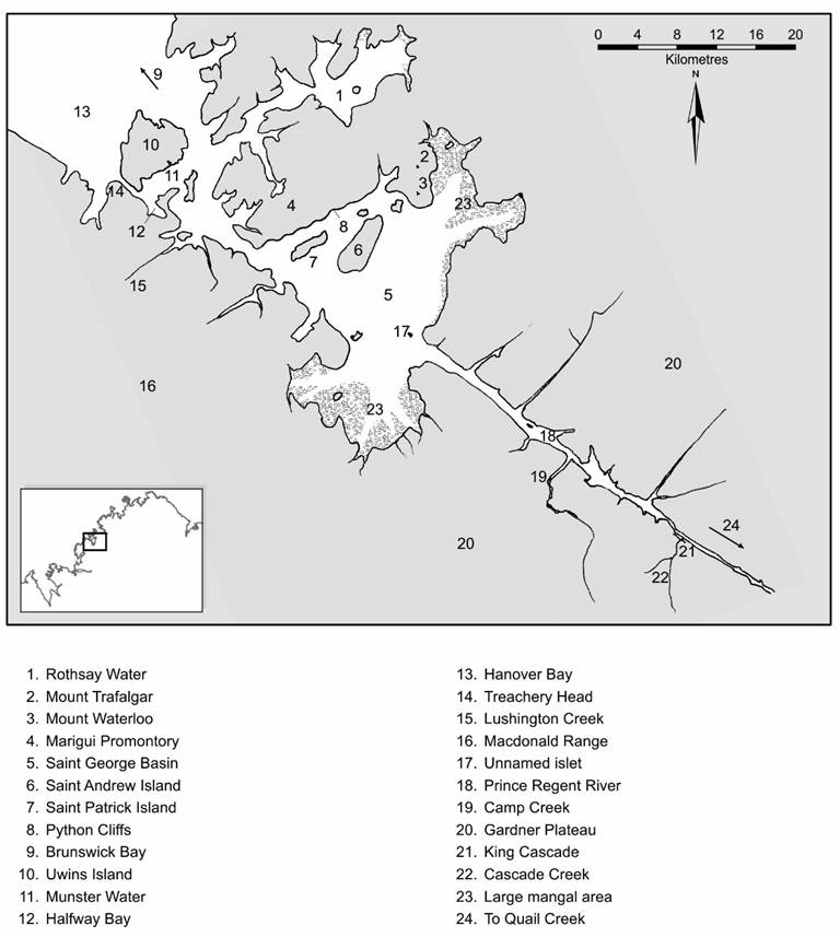
Aerial image of the zoned mangrove communities on the southern eastern side Saint George Basin Kimberley W.A. Landward of the four parallel zones of mangrove species are white, spring tide- flooded salt flats and channels off them running inland lined with a gallery of mangroves. The mouth of the Prince Regent River is centre top of the image.

Salinity and position in the estuary  There is also a gradient in salinity distribution along an estuary and this too means that different associations of mangrove species occur along the length of an estuary.

During the dry season of northern Australia for example there is reduced inflow of fresh water to estuaries from creeks and rivers. A stand of mangroves at the head of an estuary is a long way from the coast and at this point there will be reduced exchange of tidal water. These factors combined with evaporation from the estuary leads to more saline conditions. Closer to the estuary mouth however tidal exchange is more complete so salinity here remains much as it is in the open sea.

Adaptations to growing in saline water  Some mangrove species have the ability to resist uptake of particular minerals (mainly sodium chloride) by their roots while others have developed glands that excrete salt crystals onto their leaf surfaces, some of which are likely to be the washed off during high tides and rain. Salts may also be removed during leaf fall and the shedding of bark.

Excreted salt crystals on a leaf of Rhizophora stylosa (stilt mangrove).

There is the only one deciduous mangrove and it grows in the mid tidal position of river estuaries across northern Australia. This species the cedar mangrove (Xylocarpus moluccensis), changes leaf colour from green to yellow, red and orange and losses leaves during the dry season. There are suggestions that this function may be another adaptive mangrove strategy to remove accumulated salt.

Cedar mangrove (Xylocarpus moluccensis) stands out from the other mangroves when it forms its non-green leaves before becoming deciduaous. Prince Regent River, Kimberley W.A.

Dispersal of species following seed setting. There are several mechanisms used by species to distribute offspring and one involves the production of a buoyant, woody round fruit that eventually break up to release the seeds after they have fallen -both Australian Xylocarpus species have these rounded buoyant fruits that split into four parts releasing seeds.  Alternatively, many mangroves are viviparous where seeds germinate and partly develop while still attached to the parent plant. The seedling so produced is called a propagule and the stage of embryonic development reached before release depends on the species. The yellow mangroves Ceriops, produce seedlings with slender embryonic stems called the hypocotyl that is about 15 cm long in C. australis, 27 cm for C. decandra and is ribbed and up to 35 cm long in C. tagal.  In the closely related Rhizophora species the hypocotyl is also buoyant but is 65cm long in R. stylosa (long style stilt mangrove) and around 80 cm in R. mucronata (upriver stilt mangrove).

These propagules are buoyant and rely on the tidal movement to disperse once they fall from the parent plant. After varying periods in the water they may be stranded and the partly developed roots on the tip of the hypocotyl may anchor the seedling in what may or may not be a suitable habitat for the development of an adult plant.

(Above and right) Two examples of developing hypocotyls on Rhizophora stylosa following successful pollination.

Distribution of Species in Australia.  Whereas all mangrove species and most of their varieties grow in tropical waters, some like Rhizophora mucronate grow in the wet topic estuaries toward the tip of Cape York Peninsula. One like Avicennia integra, the stilt grey mangrove, only grows in estuaries of the Northern Territory with its definite wet and dry seasons. This area like the Kimberley and other parts of the Queensland coast have a monsoonal climate characterised by a wet season during the hotter time of the year and a dry season in the cool months.

In the arid tropics of the Western Australia such as the coastline of the Great Sandy Desert, there are up to nine species but further south the number of species is reduced with only one in the temperate south, Avicennia marina (grey and white mangroves).  A similar pattern of distribution is found in eastern mainland Australia with a diminution of species southward. In some bays, inlets and gulfs of Victoria and in South Australia one of the varieties of A. marina is the only mangrove species represented.

A variety of grey mangrove Avicennia marina var. australasica occurs in southern Australia. This mangal is near the tip of Gulf Saint Vincent, opposite the wharf in Port Wakefield, S.A.

Koolama Bay and Saint George Basin – Background Briefing

Koolama Bay

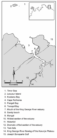
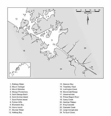
This is a u-shaped bay about 4km wide and 5km long facing NW (northwest) into the Timor Sea. It is surrounded by cliffs of Warton Sandstone that drop directly into the water on it SW (southwest) and NE (northeast) sides. The SE (southeast) of the bay has been built up from deposits from the King George River and its estuary. This is fronted with a sandy beach with about 1km deep mangrove covered wetlands to the SE, behind the beach. (See reference points 8 and 9 on adjacent map).

Tranquil Bay and Pangali Bay have been formed on the NW side of Koolama Bay where small run-off creeks have weathered and opened-up bays/inlets within cliff surrounds. Both bays have interesting natural and historic connections. (See reference points 5 and 6 on adjacent map).

A barrier beach and dune in Tranquil Bay encloses a tidal lagoon that connects the main Koolama Bay waters via a shallow channel that irregularly alternates between the north and south ends of the beach. On several locations along the back cliff wall of this bay, wet season waterfalls spill into the lagoon from the plateau above. There is plenty of fish life in the lagoon, conical shaped mud-creeper Whelks may be found from time to time on the edge of the lagoon and the tracks of a large Indo-Pacific crocodile (a ‘saltie’) are regularly seen on the southern lagoon shoreline.

Through the beach spinifex is on of the run-ff points and the cliffs behind the lagoon.
Vegetated sand dune and mangroves with the lagoon between the cliffs and the dune.

Washed up shells and coral pieces are common on the high water mark of the beach and the higher sections of the dune are stabilised with beach spinifex and goat’s foot convolvulus. A mixture of salt tolerant shrubs including two mangrove species and the beach tulip tree are found on the foreshore at either end of the lagoon.

Whelks ‘grazing’ on the organic debris accumulated in a shallow pool connected to the main lagoon.

An epic rescue of passengers and ship


The cargo and passenger ship Koolama, of the West Australian State Shipping Service sailing from Perth along the Kimberley coast had been purposefully beached at the south-eastern end of Koolama Bay after being bombed and disabled in February 1942. Volunteers who were repairing this bomb-damage holes in the hull were to complete their efforts after 10 days. The partly repaired but still greatly disabled, rudderless vessel was then skilfully backed off the beach at high tide and navigated via Joseph Bonaparte Gulf and Cambridge Gulf to the Wyndham dockside by Captain Jack Eggleston and his remaining crew.

Tenders had carried passengers and many of the crew, including Chief Officer Ken Renyolds, from the stranded vessel to a location in Pengali Bay, a small inlet off the NW side of the bay, for these people to camp at a safe distance from the ship.

In response to the initial distress radio signal from the ship and received at Drysdale Mission, 93 of those stranded at Pangali Bay were soon to be guided on a 150km arduous overland journey by seven Aboriginal men back to the Mission. The remaining passengers and crew were picked up by the mission’s lugger or flown out by a Qantas flying boat. There was no loss of life on the ship or the shore but unfortunately the unmanned pumps failed during an air raid when the Koolama was berthed at Wyndham. She started filling with water, broke her lines and sank.

Friends and family of those passengers and crew who were camped at Pangali Bay have since placed memorial plaques to commemorate the Koolama incident on the north-western cliff wall.

(A much fuller published account of this incident is given by Bill Loane, 2004, in his ‘Koolama Incident’ book)

Pangali Bay penetrates further inland than Tranquil Bay and the landward SW section has a thick stand of mangrove behind the beach and its very flat and shallow foreshore. Behind this 30m deep mangrove community is a triangular shaped grassy sandplain over 100m deep. The plain is surrounded by a gallery of mangroves with a small wet season creek draining from a ravine into the southwest corner of this mangrove.

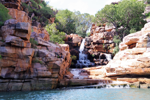
A navigable channel at the SE end of the beach leads to a relatively active creek that often continues to run over the bare sandstone after the wet season. This creek originates from the escarpment above the cliffs and passes through a number of stepped rock pools and small falls in the Warton Sandstone before reaching the salt water. This creek provided fresh water for both the stranded passengers who camped on the grassy pain and for the volunteers who remained on the beached Koolama while she was being repaired.

Freshwater stream with waterfalls and pools spilling into Pangali Bay

Pangali is the traditional name for the inlet. Tranquil Bay probable takes its name from the enjoyable ambience of this little embayment and Koolama Bay became the official name after the incident. Prior to official naming it had been referred to a Calamity Bay and prior to this Rulhiere’s Bay.  

On the eastern side of the bay, Cape Rulhiere’s forms its most NE point, this rocky projection is joined to the mainland by a sandy tombolo fronted on the bay side by a 400m long sand beach. About 12km NW of the cape is the flat isolated Lesueur Island. It is recognised at night with its flashing navigation light (four flashes every 16 seconds). Unless the sea is quite calm and flat it is difficult during daylight hours to see the island with the naked eye from the bay. Both Lesueur Island and Cape Rulhieres were named by either Nicolas Baudin on Le Geographe or his junior companion Louis de Freycinet who mastered Le Casuarina in 1803.

River sediments have filled the land on the south-eastern side of the bay and a 2.8 km sand beach has formed. Most of this tidally flooded land behind the narrow beach is connected with the estuary or a channel off the bay at the south-easterly end of the beach and is populated by mangroves. A bombing incident had force beaching of MV Koolama. Captain Eggleston had beached the Koolama in the middle of this sand beach in 1942 to save his passengers and the sinking vessel. The vessel had been built with the capability of sitting on the sea floor as was necessary in Ports like Derby with its huge tidal ranges.

Both river mangrove and long style stilt mangrove are found just behind on the spit near the river/estuary mouth. The other side of the mouth is a cliff face with a sand beach running to the SW beneath the cliff. Sediments have also formed sand bars at various points within the bay some of which are exposed during low tides but others remain covered and may be a hazard for boats with a shallow draft.

Saint George Basin

The Saint George Basin is inland from Brunswick Bay with a narrow connecting tidal channel that becomes quite dangerous even for engine powered vessels with whirlpools and strong currents created during the tidal in- and out-flow. Phillip Parker King under sail in Mermaid experienced these waters when he first entered the basin in October 1820.

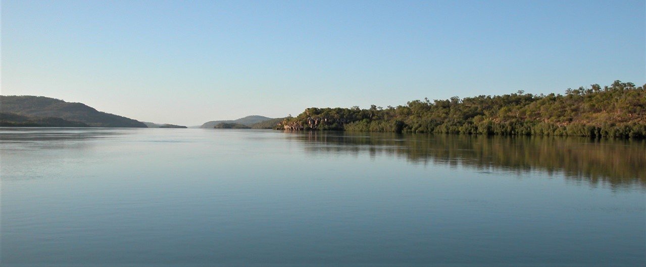
On entering Saint George Basin basin is the cliff lined mainland to the north and across the water in the same direction are some rounded hills and two flat-topped mountains. There are two relatively flat-topped islands in front of these features. Eastward across the 20km of water on a clear day, it is possible to see the foreshore margin of mangroves with a gap that marks the mouth of the Prince Regent River. Mangroves on either side of the river mouth form the largest population in the Kimberley, extending well over 100km2.

St Patrick Island (L) hiding Python Cliffs; Mt Trafalgar(391m) and Mt Waterloo(344m) in the background; rounded hill in front of mountains; and St Andrew Island (R)

The flat topped mountains are Mount Trafalgar and Mount Waterloo, and the sinuous cliffs on the western end of the basin are the Python Cliffs forming the edge of Marigui Promontory. Of the two flat topped Islands Saint Patrick is the smallest and St Andrew to its east is at least twice its size. Like the mountains, the islands have a flared apron below the cliffed margin of capping rock.

When the basin was formed it is likely that the original Prince Regent River flowed out to the sea across what has become the basin’s south -western margin. The river had cut down through its tough sandstone base of Warton Sandstone and exposed the edge of a large section of Carson Volcanic basalt rock. Comparatively the basalt weathers more rapidly than the sandstone resulting in the undermining and subsequent collapse of the sandstone above. The weathered sandstone fragments were eroded and carried out to sea, and so the wide water body forming the basin started to form. We can see where the sandstone remains as a resistant capping on the mountains, cliffs and islands and assume that over time this too will be undermined by the rapidly weathering basalt. There are a few rounded islands in front of Mt Trafalgar -these are basalt remnants of the original landscape minus a hard capping.

It is interesting to note the great difference between the rock formations in St George Basin and those for the Prince Regent River. For details see both ‘Background Briefing – overview of the Australian Kimberley’ and ‘Background Briefings – Rivers and the Well-Jointed Kimberley Landscape’

Rivers and the Well-Jointed Kimberley Landscape – Background briefing

Many Kimberley travellers particularly those visiting by sea, are generally fortunate enough to travel inland along estuaries like that of the Berkeley, King George, Hunter, Sale or the Prince Regent rivers. This article presents two contrasting river estuaries, one where the now flooded valley has been controlled by many angled joints as seen along the King George River, the other the Prince Regent River where the estuary follows a single straight joint. The King George River ends in Koolama Bay and the Prince Regent River terminates at Saint George Basin. Features of both the bay and the basin are considered in a separate Background Briefing article.

During their formation the course of the river valley is determined by many factors as run-off rainwater follows the effect of gravity heading downstream toward the sea. Water may run over rock surfaces that vary in their resistance to the flow such as a ‘tough’ quartzite or a ‘soft’ siltstone. The resultant depth of the are rills, gullies or valleys formed in less resistant rock is likely to be deeper than that which is resistant to weathering.

As modern day travellers we are unable to follow these early stages of river valley formation in the Kimberley but two of the Kimberley estuaries, the King George and the Prince Regent rivers provide superb examples where after many, many million years the pattern of the rock jointing has had a major influence on the shape of the resulting valleys and the estuaries they now fill in their tidal section.

A primer – rock joints, weathering and erosion, land uplift and sea levels.

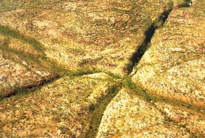
Aerial view of joints in sandstone on the north-eastern side of the Prince Regent River (Source: Google Earth)

By definition, joints are rock fractures where either side of the fracture has not been substantially displaced laterally (to the left or right) or vertically (upwards or downwards). If displacement were to occur the fracture is referred to as a fault.

Running through most of the Kimberley rock surfaces are deep joints a feature that is not immediately evident to the average observer walking across a landscape. However, when identified by field geologists and mapped from broadscale aerial images taken from aircraft or satellites, we see joints that are quite numerous and follow a pattern. Although the joints may vary in length, they are mostly straight and over the Kimberley are oriented in either SE (southeast) to NW (northwest) or a SW (southwest) to NE (northeast) direction. It is believed that the alignment of the fractures in the rocks initially resulted from tremors emanating from earth moving tectonic forces that were building mountains along the east-south-east and the south-south-western edges of the Kimberley block 1,000 million years ago.

Under the influence of gravity runoff water flows downwards and this may be interrupted when it enters a waterbody such as a lake and ultimately stops at the level of the sea. During the flow water may be channelled into joint fractures and low points where frictional forces of the water tend to wear way the rock particles so making the joint wider and deeper. Any previously weathered rock sediments carried by the water increases friction thus accelerating weathering and forming deep channels. Should any crossing, intersecting joint offer a ‘better’ downhill direction the flow will match the new direction. As a result, water flow may follow joints that take a zig-zag route so determining the channel direction of the resulting creeks and rivers on their way to the sea.

Uplift of the Kimberley has occurred in the past on a couple of occasions many 100s of million years ago. A result of these massive uplifts the rivers too were uplifted and had further to drop to reach sea level. In terms of their land forming processes, rivers have rejuvenated powers of weathering and erosion so uplift is likely to result in the deepening of river channels. Cutting down to the base level by rivers was therefore determined by the sea level. With low sea levels in the past, river channels near the sea were much deeper. When sea levels rose again these valleys were flooded.

Most of the weathering and erosion events to produce today’s landforms were stimulated by an uplift just 20 million years ago.

Globally sea levels are intimately connected with temperature averages across the Earth. During cold conditions the volume of water in oceans and seas shrinks and in extremely cold water ice sheets and glaciers form so the liquid water is tied up as a solid thus reducing the level of the oceans and seas. Over time such glacial/ice age conditions may alternate with warmer interglacial) times when water expands, and glaciers and ice sheets melt. Phases of glacial-interglacial events have occurred multiple times during the relatively recent geological Pleistocene epoch that lasted over two million years

With very few mainland glaciers and being distant from the Antarctic, Australia contributed little to the freezing and thawing of water but by connected to the sea was still influenced.

The last ice age in this sequence was the most intense and is referred to by earth scientists as the Last Glacial Maximum (LGM). During the LGM Oceans around Australia saw water receded by a depth of 120m compared to today’s average high tide mark. Around the country this exposed the continental shelf which, for parts of the Kimberley, meant that the rivers valleys extended over the exposed continental shelf for up to 320km to deposit water in the Timor Sea. By way of contrast the narrow shelf as found along most of the NSW coastline had only few 100m exposed.

Timewise, the LGM occurred about 20,000 ya (years ago) and the interglacial melt began about 17,000 ya. As sea level rose the river valleys were flooded until the temperatures and the melt stabilised around 6,000ya. Existing valleys penetrated inland to varying distances so their lower section became tidally flooded and referred to as estuaries.

It is interesting to contemplate that Aboriginal ancestors lived through the colder conditions of the LGM and experienced the exposed shelf, and then the loss of land as the seas rose.

See ‘Background Briefing -overview of Australia’s Kimberley’ for further details.

King George River estuary the twin falls

King George River enters to Timor Sea after discharging into Koolama Bay in the north-eastern corner of the Kimberley. In the SW corner of the bay this river estuary remained hidden from the sailing explorers including Nicolas Baudin in 1803 and Phillip Parker King 1820.

It was not until 1911 that the upper part of the King George River was discover discovered and named by Europeans with an accurate prediction by the discoverer, C. Price Conigrave, of where the river would terminate i.e. Koolama Bay, then known as Rulhieres Bay.

In the eyes of the Traditional owners the lower reaches of this river formed the border between the country of the Miwa speaking people to the west and Kwini country to the east. Since Native Title Land ownership was finally determined in 2013 the area is under the control of the Balanggarra Land Corporation, for the Balanggarra Traditional owners.

Naming some local features

Koolama Bay was named after the ship Koolama was beached here during World War Two. Prior to this it had unofficially been called Rulhieres Bay after the rocky Cape Rulhieres on the north-eastern mouth of the bay and then Calamity Bay. The Cape had been named in honour the French administrator and diplomat Claude Carloman de Rulhière (1735-1791) by Nicolas Baudin (Captain of Geographe) or Louis de Freycinet (master of La Casuarina) when they sailed past in June 1803.

King George River was named by Charles Price Conigrave in honour of King George V. George V succeeded his father Edward VII in 1910.

Features of the River and Estuary

In contrast to the rest of the Kimberley coast, where tidal ranges are meso- (in the 2 to 4m), macrotidal (4 to 8 m) or even greater, this small section of the coast including Koolama Bay and the estuary is subjected to mostly microtidal conditions with just over two metres difference between the highest and lowest tides.

The low tidal range for this estuary means there is not a massive twice-daily in and outflow of tidal waters and these conditions have allowed the development of islands of sediment along the estuary that are populated by mangroves and shallower water populated with sea grasses. Under the current conditions, with the sand spit build-up near the estuary mouth makes this gap quite narrow and from a distance, difficult to distinguish from a 2.8 km long mangrove lined sandy beach to its east and the cliff on the other side

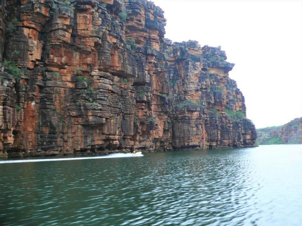
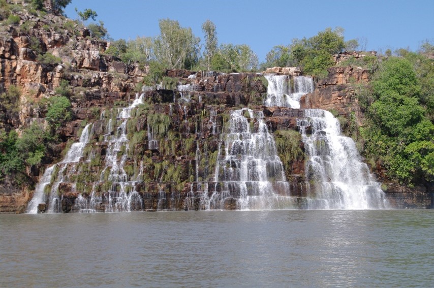
The rest of the large bay is surrounded by cliffs formed from Warton Sandstone one of the typically ‘tough’ Kimberley sandstones. This same rock lines either side to the 13 km long estuary as it zig-zags inland to terminate in twin waterfalls carrying King George River freshwater off the Karunjie Plateau.

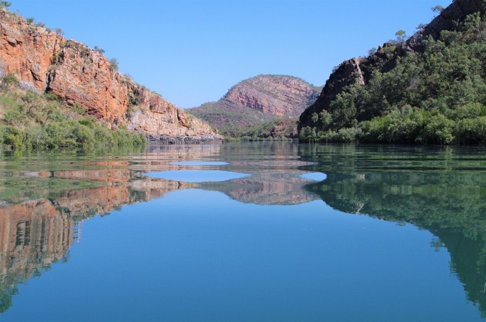
Cliffs of Warton Sandstone line either side of the estuary as it zig-zags towards the waterfalls

The zig-zag channel of the river has followed the pattern of joints in the sandstone and these are aligned in either a SE to NW or SW to NE direction. Opening-up of the joints to form the river channel took place many millions of years ago as the river slowly weathered the sandstone. This has been supported by much wetter conditions in the past. At this time the current Koolama Bay is likely to have been much further out to sea and the bay itself may have been non-existent or quite a different shape without a perimeter of cliffs.

Although the Warton Sandstones were formed over 1,800 mya (million year ago) specialist earth scientists (geomorphologists) suggest that the land-forming processes on the Kimberley coast have produced most of today’s major landforms in the last 20 mya. During this period one could imagine the King George River initially discharging directly into the sea and that the earliest waterfall developed once the land had been uplifted. It is the processes of weathering (wearing away) and erosion (removal of weathered products), brought about by moving water, that have enabled the formation of a deeper cliff-sided channel and the progress of the waterfall inland which has formed this estuary.

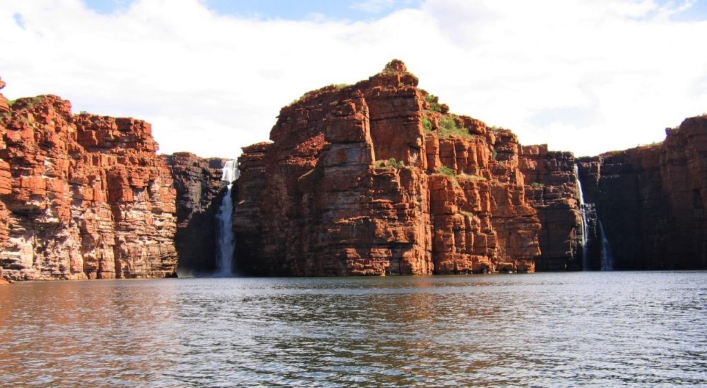
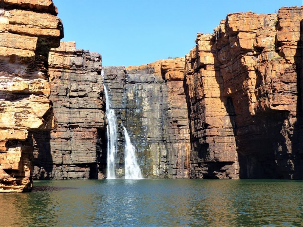
The twin falls at the head of the King George River estuary

In traditional Lalai stories these majestic falls were created by a male and female rainbow serpents, Wungkurr, who travelled from their distant country to the west, the Sir George Moore Islands. As they travelled inland the river was created.

Today the estuary is over 13 km long and ends in a pair of waterfalls pouring over 8Om cliffs. This long drop particularly during the wet, creates two deep plunge pools beneath falling water. On one occasion echo sounding measurement found the river to be 62 m deep below the eastern most fall. As the river flow decreases following the wet, flow in the west fall creases but that on the east continues though reduced to trickle at the end of the dry. Elsewhere the estuary channel depth varies considerably with most water depths less than 10 m with very moderate tidal effects.

The cliffs both around the Bay and lining the estuary expose the very blocky nature of the weathering Warton Sandstone. The blocks vary greatly in size but tend to have relatively straight margins and in places look as if they were engineered and positioned by modern cranes or past giants! The horizontal lines of the blocks follow the margins of successive layers of sediment from when the sandstone was being deposited. The vertical block surfaces are those of joints created well after the sandstone was rock had consolidated and after earth tremors had passed through the area.

The blocky Warton Sandstone around the westerly fall. This fall ceases early in the dry season.
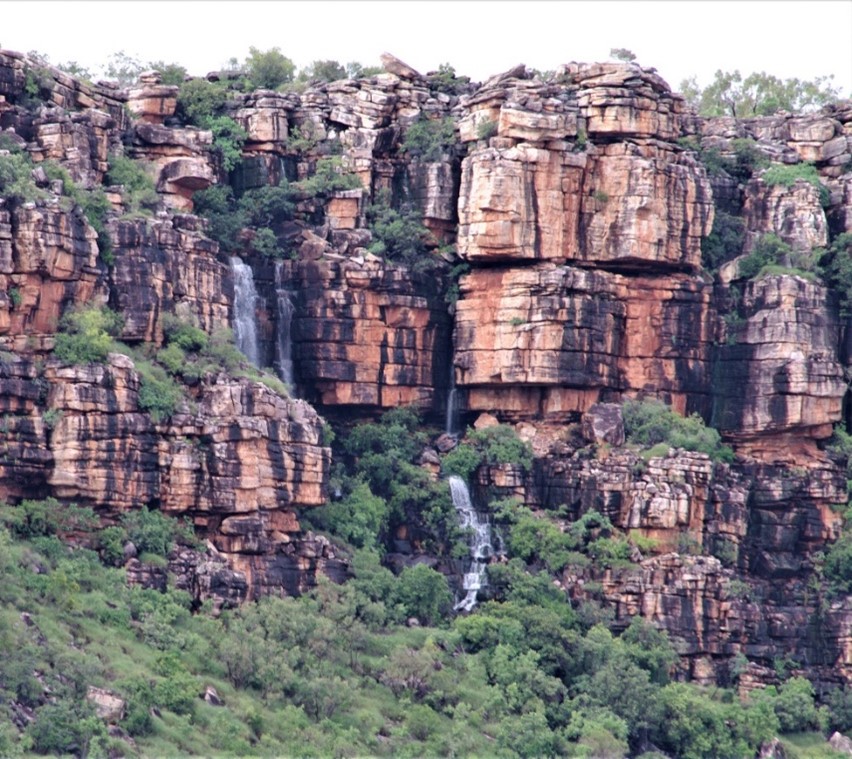
The small falls as seen along either side of the estuary cease towards the end of the wet season. The black streaks of cyanobacteria indicate surfaces that are/were saturated during the wet.

The Prince Regent River and Estuary

The Prince Regent River has been known to Europeans since its discovery by Phillip Parker King in October 1820.  He had sailed into St George Basin an inner basin of Brunswick Bay. King continued his explorations by travelling from the Basin in a whale boat up this newly discovered Prince Regent River on an incoming tide. His ship Mermaid remained anchored in the Basin.

Looking up-stream from the estuary mouth along the straight Prince Regent River.

This basin and river area is the homeland of the Adbalandi clan who were within the territory covered by the Worroran language and its people. This local country was traditionally referred to as Malandum. Their land was mainly on the southern side of the river with country to the north bordered by people who spoke the Wunambal language. Many of the Lalai (Dreamtime) stories of creation relating to river and that of St George Basin, the river and King Cascade, are told in both languages.

Prince Regent River begins its +100 km course originating near the foot slopes of and Mt Agnes (735 m above sea level). It follow a zig-zag joint path from the mountain slopes and then follows a relatively straight NW-SE joint line. But for one small section on the upper straight where the channel deviates a little then runs for 70 km to St George Basin. For at least half of this distance, the section that was explored by King, the estuary is influenced by the oceanic semidiurnal tidal pattern of two highs and two lows each 24 hours and 50 minutes. Still on the river and returning to the Mermaid, King decided that rather than rowing against the tidal current they were to sleep in a small river island -here he estimated that  the tide had risen by 30 feet (between 9 and 10 metres) during the night between the low and high.

An aerial view of the river illustrates the checkerboard nature of the rock joints and shows that where the main channel is joined by a tributary it tends to enter at right angles having cut its channel along a NE-SW joint. One of the larger sized navigable tributaries, referred to a Camp Creek, runs its first 3 km to the SW along a straight channel.

A most historic and interesting feature about 32 km upstream from the Basin is a 200m wide cascade below Cascade Creek and it falls into a large pool that also enters the main channel at right angles. As this creek is spring fed means that it tends to have some flow of fresh water even during the dry season and is not wholly dependant on the wet season flows. The cascade is rock stepped and drops about 45 m to the tidal pool which during very low tides, exposes large expanses of its muddy base.

An early dry season flow over King Cascade q

The rock type here and for the majority of the Prince Regent River course is Wunaamin Mulliwundi Sandstone (previously known as King Leopold Sandstone). This is a relatively resistant rock type and most of the river and estuary lies between rocky resistant sandstone cliffs. The valley between the parallel cliffs is about 200 m wide but narrows further upstream. Downstream the valley has been widened in a few locations due to the presence of a less resistant rock. At these points there is evidence of the rock, Hart Dolerite.

(L)Typical sandstone cliffs that line most of the estuary. (Above) A residual rounded hill of Hart Dolerite.

About 1,760 mya molten Dolerite lava the was forced between the sandstone strata and cooled to fill joints and form horizontal sheets called sills. Dolerite, unlike the resistant sandstone is easily weathered when exposed to air and water. As the river channel has deepened it cut across a sill embedded in the sandstone. Once exposed it weathers and undermines the sandstone as weathering products are washed away. With no support the sandstone falls and the so gradually widening the channel at this point. The Dolerite is dark in colour and when weathered forms reddish soil. Weathering of large, above ground sills of Dolerite forms rounded hills unlike the sheer rocky landforms of sandstone.

A patch of weathering Hart Dolerite

Further reading:

See ‘Background Briefing -features of Koolama Bay and Saint George Basin’ for the changed geology and landforms once the Prince Regent River estuary reaches St George Basin.

Overview of Australia’s Kimberley – Background Briefing

Location and climate

The Kimberley is a remote location of Western Australia that makes up the northern section of this State and in area the Kimberley Region is larger than the island of Ireland. 

It is located in the tropics with a monsoonal climate that results in hot wet conditions during the summer and cooler dry winters between April and September. The north and northwest Kimberley are bordered with a coastline on the Timor Sea for the north and the Indian Ocean to the west. The south borders arid regions close to the Great Sandy Desert and the Tanami Desert, and to the east it shares a border with the Northern Territory.

Map sheet with the comparative sizes of some countries and states with Australia.

Roads and Access

That much of the Kimberley is not intensively developed means limited road development and so travel by land is greatly limited to the ‘black top’ (sealed road) during the wet season. The major Kimberley road is the Great Northern Highway linking Western Australia to the Northern Territory and even it may be closed to traffic as a result of flooding as it was in 2021.

It is only possible during the wet season to access by road the large townships of Kununurra, Derby and Broome and a few other smaller places like Wyndham, Halls Creek and Fitzroy Crossing.

These road and track limits are recognised during all times of the year especially by those wishing to visit the Kimberley coast. Further, it also means that there is a visitor influx during the dry season from mid-May to September and even then there are limited road vehicle routes servicing large swathes of the coast. While the highway between Kununurra and Derby skirts around the central Kimberley and it’s inland features, the unsealed Gibb River Road, the Kalumburu Road, the track out to Mitchell Plateau and property access roads offer, particularly during the ‘dry’, the main accesses to the see inland landscape features.

The dramatic falls on the Mitchell River.

Traditional Owners and Pastoralist

Distribution of the main Kimberley coastal and near-costal languages.

While pastoralist landholders have been in the Kimberley since pioneers like Nat Buchannan,  the MacDonald’s at Fossil Downs and the Durack’s droved cattle there in the 1830s, Aboriginal clans have known these lands for many tens of thousands of year.  The first inhabitants became widely distributed and local groups developed their own language. Today, following linguistic studies we know there were thirty Kimberley languages. Significantly, language distinguished these groups of the First People and their traditional lands. Around the coastline between Cambridge Gulf and Yampi Peninsula there were at least six separate languages, several of which fall within the Worroran group. While several of these languages are still spoken some have just a few speakers and one, the Miwa language from the northeast Kimberley, is extinct.

In recent times there has been several generally protracted legal proceedings resulting in the rightful granting and restoration of traditional land ownership. In some cases, such as the Balanggarra Corporation, the lands restored to traditional ownership incorporate several language groups and their country from the Cambridge Gulf west to Carson River as well as Sir Graham Moore Islands. In detail, as outlined in the Balanggarra Corporation and published on their website the claimed area includes – 

‘…….the Kalumburu, Oombulgurri and Forrest River Aboriginal reserves, Carson River pastoral lease, parts of the Drysdale River National Park and unallocated crown land at Cape Londonderry, Carson River and the Cambridge Gulf coast. The northern boundary runs through sea country and encompasses a number of islands near the coast, including the Sir Graham Moore Islands, Adolphus Island and Reveley Island.’

It is interesting to note that ‘custodianship’ rather than ownership of traditional land more accurately reflects the Australian Aboriginal view of their relationship with their Country.

Geology and Landforms

In geological terms the Kimberley originated as a small continental land mass that became ‘welded’ to the northwest of what were the foundation blocks of Western Australia -the Pilbara and the Yilgarn plates. This joining occurred over 1,830 million years ago. At this time physical land forming processes like rock weathering, erosion and deposition of sediments were ongoing on this newly joined segment. Weathered sediments from high country were being eroded by rivers and deposited in water in a shallow but extensive basin thus covering what we recognise today as the Kimberley Block. This block developed with multiple formations of several sedimentary rocks (sandstones and siltstone) being deposited on the river deltas within the basin. After the first formation had built up there was an episode with the outpouring of extruded volcanic rock that cooled to form thick layers of basalt over most of the basin. A further four distinctive sedimentary rock formations were later deposited above the basalt. Cumulatively these events occurred over a +40 million year period around 1,800 years ago and the six main formations that formed the Kimberley Block/Plateau are referred to by geologists as the Kimberley Group.

In the following diagram, the name of King Leopold Sandstone has been changed and is now referred to as Wunaamin Milliwundi Sandstone.

The sequence of rock formations the now form the Kimberley Group and make up the Kimberley Block.

Whereas these particular formations dominate the majority of the Kimberley land area, there are later formed sections such as that in the south west where marine coral reef flourished over time producing the fascinating limestone landforms we see in Bandilngan National Park at Windjana Gorge. At another location to the east of the block, sediment deposits have developed as seen in Purnululu National Park and formed the Bungle Bungle Ranges with their outstanding beehive-shaped landforms.

Since its formation the Kimberley Block has been uplifted as a plateau on a few occasions and its uplands have undergone millions of years of weathering and erosion to develop the landscapes we typically see in the Kimberley. These land forming processes have left a few higher mountain points, produced many ranges and a network of mostly seasonal rivers that have carried sediments out to sea where they were deposited. The result is 1000s of wonderful landscapes for discerning travellers.


Sandstone dominated country and the icon Kimberley boab trees near Windjana Gorge.
The main rivers and many of the Kimberley uplands.

In addition to road travel many travellers elect to visit the many bays, basins, islands and river estuaries during a cruise around the coastline to capture a completely different perspective of Kimberley landscapes. Not only does this form of transport offer an easier mode of travel than some of the bush tracks but it exposes an abundance of landforms and landscapes. Many of these owe their magnificence to the diverse rock colouring, sculpturing through weathering or fascinating architecture which has arisen from the jointing and folding of the Kimberley Group rocks. The rise of sea levels after the last Ice Age has led to the formation of the multitude of Kimberley islands, the flooding of coastal valleys to form estuaries and the endless array of cliff structures.

In addition to road travel many travellers elect to visit the many bays, basins, islands and river estuaries during a cruise around the coastline to capture a completely different perspective of Kimberley landscapes. Not only does this form of transport offer an easier mode of travel than some of the bush tracks but it exposes an abundance of landforms and landscapes. Many of these owe their magnificence to the diverse rock colouring, sculpturing through weathering or fascinating architecture which has arisen from the jointing and folding of the Kimberley Group rocks. The rise of sea levels after the last Ice Age has led to the formation of the multitude of Kimberley islands, the flooding of coastal valleys to form estuaries and the endless array of cliff structures.

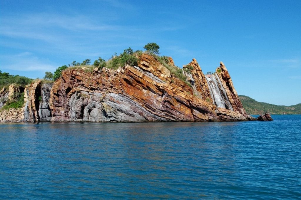
Dramatically coloured and folded landforms at Nares Point, Yampi Peninsula.

Cruising the Kimberley

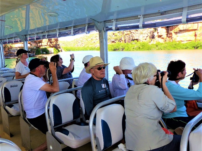
The majority of my Kimberley travel has involved cruising on Coral Expedition vessels.  Beside providing a high quality of accommodation and dining, this small ship company offers a unique form of travel for sightseeing off their main vessels using their Xplorer tenders.

Comfortable Xplorer travel off the main vessel.

 These offer comfortable seated travel during ventures offering shade, protection from wind and rain if required, toilet facilities and amplified commentary from an experienced Expedition team. Xplorer’s also provide quick travel when visiting more distant sites and may travel in shallow waters. The have easy boarding operations when visiting beaches or transferring into Zodiacs to venture into mangroves, to bird watch or to view waterfalls from close quarters.

A drop-down walkway enables easy beach land.

Follow up

The Background Briefing articles on the Kimberley that follow this introductory overview are based on my multiple annual visits during each of the 22 years I have been enjoying these sea ventures and interacting with passengers in the role as a Guest Lecturer.

Talbot Creek – Background briefing for travellers in Kimberley, WA

Kimberley Coast Western Australia

The ‘Kimberley Landscapes’ post introduces many of the names and process mentioned in this article. Readers may find it a useful supplement to other articles about the Kimberley coast.

This post could also be read in association with that on the ‘Horizontal Waterfalls’.

In these articles I generally refrain from describing the magnificence of the local landforms but give a broad outline of the formation of the landscapes and a little of their natural history in the hope that these explanations may remove some of the bewilderment about how such natural, often complex wonders originated.

Talbot Creek

This creek, like the Horizontal Waterfall complex, joins Talbot Bay at its south eastern end.

The earth-moving forces that caused the steep folding of the rock formations at the Horizontal Waterfalls certainly folded the rock strata we see along the creek, but to a lesser extent (compare right and left of Figure 1). Over time the same weathering and erosive mechanisms have reduced many of the high points produced by folding to ‘stumps’ (as shown in Fig1 by the C shape) and these forces have acted to remove the less-resistant Elgee Siltstone and the Carson Volcanics formations with any un-weathered part mostly below the water. These mechanisms have involved flowing creeks that have cut down and opened-up gaps in the two of the more resistant sandstone rock ridges. Compared to the Horizontal Waterfall complex the two gaps along Talbot Creek are wider, and although the water rushes through these in response to tidal changes they do not offer enough resistance for the formation of horizontal waterfalls.

Figure 1. A diagrammatic section through the southern end of Talbot Bay to illustrate the relationship between the Horizontal Waterfalls (r. h.), Slug Island (middle) and along Talbot Creek (l. h.). Details of the effect of folding, weathering and erosion of the various rock formations, and the position of sea level following the last ice age is also shown.

Like the remnants on the walls of the embayments in the Horizontal Waterfalls complex, there is also plenty of evidence to show that particular rock types originally filled the spaces now filled with the Talbot Creek channel or tidally flooded lowlands covered with mangroves. The most prominent remnant is a narrow ridge (Fig.1 #15; Fig.2 #14) of Elgee Siltstone formation rock. This ridge is a formed from a bed of resistant conglomerate (Fig. 3) and not the soft siltstone beds typical of the Elgee Siltstone formation. There are also traces of this formation remaining on the tide washed wall (Fig. 2 #4). This sample (Fig. 4) also shows the wave like traces of micro folding compared to the large-scale folding that produced the surrounding ridges (Fig. 5).

Fig. 2. Showing details of the landforms and features along the estuary of Talbot(Cyclone) Creek
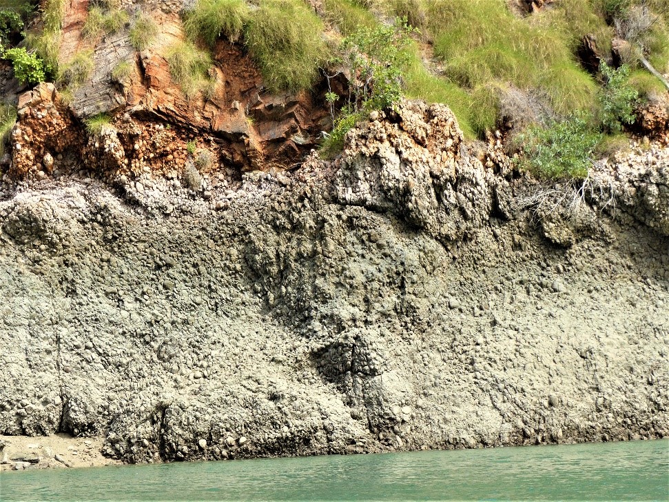
Fig. 3 Elgee Siltstone conglomerate found along the walls of the narrow ridge in Talbot Creek at low tide
Figure 4 Micro folding in the Elgee Sitstone found along Talbot Creek..

A cruise out of Talbot Bay and along its estuarine creek takes a circuitous route through the first gap (Fig.2 #3) which has been cut down through Pentecost Sandstone . This leads into and embayment once filled with the easily weathered strata of Elgee Siltstone and towered over by the  high ridges of Pentecost Sandstone on both its northwest and southwest (Fig. 5). These are fairly shallow waters with a well developed mangrove community to its southeast. The creek channel follows a straight 3.5 km path to the southeast between a thin ridge of conglomerate dominated Elgee Siltstone and a rocky sloping ridge face of Warton Sandstone that dips down under the channel (Fig 2, #14 and #5). At the end of the straight is another gap (#15) cut through the Warton Sandstone with the creek channel flowing through this  into a space once filled with Carson Volcanics basalt.

igure 5. Looking across the embayment originally occupied by Elgee Siltstone toward the gap in the ridge formed of Pentecost Sandstone. The mid background feature is one of the residual sandstone ‘stumps’.

Like the second embayment of the Horizontal Waterfalls complex, remnants of Carson Volcanics basalt many be spotted above  the mangroves on the lower slopes of the Warton Sandstone. Further along this mangrove filled emabayment formed by Talbot Creek there are dark mounds of large black boulders on the surrounding low hills. These are not formed from Carson Volcanics rock but remnants of Hart Dolerite that once intruded the Volcanics (Fig. 4; Fig. 2 #8). Much of this lowland space is flooded during high tides, it is intersected by creek channels, has some salt flats at its margins and supports several mangrove species.

Figure 6. Mounds of Hart Dolerite along Talbot Creek that once intruded the Carson Volcanics

Much of the hilly country around the estuary supports savannah woodlands dominated by eucalypts, particularly northern woolybutt (Eucalyptus miniata) with an understory of grasses and patches of wattle. Some of the high slopes (background Fig. 5) with massive sandstone exposures may carry a small, powdery white, smooth barked Eucalyptus rupestris.This small tree has with no common name but a species name meaning ‘rock loving’ (Fig. 7) . On the ridge above the mico-folding (Fig.2 # 4) are a number of the native northern pines, Callitris intratropica, growing on the ridge (Fig. 8). As species, and as the name suggests these pines are distributed  across tropical nothern Australia. Another less common small tree, a Kurrajong, which flowers toward the end of the dry season when it is deciduous. The bright red flowers of this Kurrajong (Brachichiton viscidulus) may be seen on a few trees at the nothwestern end of the Eleee Siltstone ridge (Fig. 2 #14). This species has no common name and is often distinguished by it sticky fruits (Fig. 9).

Figure 7. Eucalyptus rupestris in its rocky habitat.
Figure 8. Mid-left -native northern pine growing on the ridge.
Figure 9. Red flowering Kurrajong on the end of the Elgee Siltstone ridge.

Kimberley Horizontal Waterfall – Background briefings for travellers in WA

Notes for travellers in Western Australian Kimberley on landscapes near Talbot Bay.

The ‘Kimberley Landscapes’ post introduces many of the names and process mentioned in this article. Readers may find it a useful supplement to other articles about the Kimberley coast.

This post could also be read in association with that on the ‘Talbot Creek’.

In these articles I generally refrain from describing the magnificence of the local landforms but give a broad outline of the formation of the landscapes and a little of their natural history in the hope that these explanations may remove some of the bewilderment about how such natural, often complex wonders originated.

The Horizontal Waterfalls

Overview

The Horizontal Waterfalls (HW) are found in the south western corner of Talbot Bay a deep bay located on the north side Yampi Peninsula east of Koolan Island. Rather than horizontal rock formations this corner of the Kimberley is made up of well folded formations and in the vicinity of the HW folds were so steep to be nearly perpendicular (Fig. 1). This meant that the local rock formations including the Wunaamin Miliwundi Sandstone, Carson Volcanics, Warton Sandstone, Elgee Siltstone and Pentecost Sandstone that were originally horizontal and over 4 km deep were folded, in parallel, to stand vertically.

Figure 1. View through the first gap in the ridge and into the first embayment during a turbulent outflowing tide. On the other side of the embayment is the second gap in a ridge and is the entrance into another (smaller) embayment. The ridge in the distance, McClarty Ranges is about 3km away and has no gap.

What happened to make today’s phenomenon?

Today the set of landforms at the HW (Fig. 2) are made up of three ridges (#3, #5 and &7), two with gaps (#10 and #12) through them and two embayments (#11 and #13). The embayment are flooded valleys between the three ridges. Tidal water from Talbot Bay (#1) may flood in through the outer gap to fill the first embayment and as it rises forces water through the second gap to fill the inner embayment. As the tide falls, the flow is reversed and the level of water in the embayment drops again. In brief it is the narrow gaps and the high tidal ranges in Talbot Bay that creates the waterfall-like flow.

Figure 2 Map of the landforms at the southeast end of Talbot Bay including those of the Horizontal Waterfalls and Talbot Creek. (NB #7 McClarty Ranges is formed from Wunaamin Milliwundi Sandstone, the new name for that originally named King Leopold Sandstone.)

The high hills and deep valleys resulting from folding through past orogenic (mountain building) activity would then have been subjected to weathering and erosion (Fig.3 #1). Once the tops of the high points were removed each of the five formations would have been exposed end-on. As illustrated on the right hand side of Fig.3, the three sandstone formations (#9) would be least affected and weathered at a relatively slow rate to remain as ridges. However, the Carson Volcanics (#3) is less resistant due to its basaltic composition and has been chemically weathered. The Elgee Siltstone (#5), because of its physical weakness, would have been easily removed by running water. Most of this weathering and erosion occurred during times of lower sea level and the base the Volcanics and Siltstone is currently well below the low tide mark (#10 and #11), hence they are continually flooded and form today’s embayments.

Figure 3. A diagrammatic section through the southern end of Talbot Bay to illustrate the Horizontal Waterfalls, Slug Island and along Talbot Creek to illustrate the effect of folding, weathering and erosion and the rise of sea levels following the last ice age

The two gaps (Fig. 1) are likely to have formed as creek water escaping from the higher landforms cut down through joints in the Warton Sandstone and the Pentecost Sandstone. These creeks would also have carried away any products of weathering. The inner embayment deepened because of the rapid chemical weathering of Carson Volcanics and it is possible today to find remnants of basalt on the sides of this embayment (Fig.2 #6). The outer embayment represents the space where Elgee Siltstone once stood but because of its susceptibility to physical weathering by running water it too has been lowered well below current sea level. Like the Carson Volcanics remnants of the siltstone also remain on the embayment walls (Fig.4 ; Fig. 2 #4). The outer ridge is formed from Pentecost Sandstone, the middle ridge from Warton Sandstone and the inner wall, without a gap is formed from Wunaamin Miliwundi Sandstone.

Figure 4. Remnants of Elgee Siltstone in the first embayment near the second gap of the Horizontal Waterfalls. An indication of the tidal range is revealed by the dark surface of the siltstone (due to Cyanobacteria growth) that is regularly covered with tidal water.

The section of the coast outside Talbot Bay is subject to maco-tidal conditions (greater and a 4 m range) and as the tidal influence moves deeper into the Bay it tends to intensify. As the high tide water builds the narrow gaps resist the flow the water, it builds up on the outer side and has to run ‘down hill’ into the first embayment (Fig. 5). This creates one horizontal waterfall that is repeated at the second gap. These flows are all reversed with the outgoing tide and between these tides there are short periods of slack water.

Figure 5. Looking along the northwest side of the first embayment, Horizontal Waterfalls.

Boating operators taking passengers through the Horizontal Waterfalls are required to observe safe practice given the ferocity with which the water moves especially during Spring Tide events of the lunar month as occurs over the full moon and new moon periods.

Sea levels reached their current level some 6,000 year ago and prior to this the tidal flow would have progressively moved further out of Talbot Bay and eventually at the peak of the last Ice Age, 18,000 to 20,000 years ago, seas were some 120 m lower than today. Given the very wide continental shelf in this part of Australia the shoreline then would have been 100 km seaward. At this stage we could imagine that Poulton Creek (Fig. 2 #16) which runs into the inner embayment would have flowed as a stream out through the two gaps, possibly fallen over a waterfall into Talbot Bay where it joined Talbot Creek out of the bay and across the continental shelf to the sea.

We must conclude that in Geological Time this is a very recent event and although the current conditions may be adding to the weathering and erosion, these were not what led to the initial development of this somewhat unique set of landforms.

Figure 6. An inflatable boat about to ‘climb’ the horizontal waterfall out of the second embayment through the narrower (and more dangerous) second gap during a building high tide..

Kimberley Plateau – Background briefing and introductory notes

In these articles I generally refrain from describing the magnificence and uniqueness of the local landforms but give a broad outline of the formation of the landscapes they are part of, and a little of their history in the hope that these explanations may remove some of the bewilderment about how such natural, often complex wonders originated

 The Kimberley is a large regional area of north west Western Australia and fronts the Indian Ocean and the Timor Sea to its west and north, with the Great Sandy Desert to its south and the Northern Territory to the east. Being in tropics means the Kimberley is warm to hot throughout the year with a climatic pattern described as monsoonal with hot and wet summers and cooler dry winters

The Kimberley (Adapted from kimberleysociety.org)

Two major rivers, the Ord and the Fitzroy arise in the south east Kimberley around Mount Wells (983m) the regions highest point. The Ord tracks east then north via Lake Argyle to Cambridge Gulf north of Wyndham and the Fitzroy flows to the diagonally opposite south eastern corner of the Kimberley and after being joined by several tributaries discharges in King Sound northeast of Derby. There are many other rivers flowing off mounts and ranges on the central Kimberley Plateau and like the Ord and Fitzroy are seasonal, responding the to the wet season for their major flows usually between October to April, with greatly reduced flow volumes during the long, intervening dry season.

Physically the Kimberley is composed of a number of regions but the largest and most prominent is the Plateau that occupies its main northern and western section and forms the majority of the Kimberley’s coastline. This region lacks any large towns but has several smaller ones with many Indigenous centres and outposts. Other than those connected by sealed roads (the “black-top”) most of the smaller communities remain somewhat inaccessible by road during the wet season.

Makeup of the Kimberley Plateau

The rock of Kimberley Plateau began its history over 1,800 million years ago (Ma) when sediments from surrounding mountains were deposited in a large, shallow marine basin with dimensions of at least 450 km north to south and over 400 km east to west. Rivers carrying sandy sediments would have fanned out over the basin and deposited their load forming what is todays Wunaamin Miliwundi Sandstone (formerly referred to as the King Leopold Sandstone) that was built up to depths of more than 800 m in some locations. Following this event that lasted for several million years volcanic lava was extruded over the surface of the sandstone.  On cooling this mainly basalt rock varied in depth from 60m deep to over a kilometre. This rock is referred to as the Carson Volcanics. The eruptions were not from typical volcanic cones, but from surface fissures and the lava flowed and filled in hollows and valleys where it became the deepest and remained shallower over higher surfaces of the Sandstone.

The Kimberley Basin formations and Hart Dolerite intrusions making up the Kimberley Series

Following another pause over many millions of years new mountains had arisen and the basin had continued to slowly sink. The new lot of sediments formed another sandstone to be spread over the Carson Volcanics.  This sandstone is referred to as the Warton Sandstones and dating of Zircon crystals from within the sandstone suggest a maximum age for this formation of 1,786 Ma. Two later formation-forming episodes led to the deposition of Elgee Siltstone and over these thick beds of the Pentecost Sandstone.

(above) Cliff of Warton Sandstone (Berkeley River) & (below) Hart Dolerite intruded under hills of Wunaamin Miliwundi Sandstone (Prince Frederick Harbour.

Two other rock types found in the Kimberly Basin group are those of the Yampi Formation and Hart Dolerite. Unlike the earlier formations Yampi Formation has a distribution limited to the south west of the basin and it this sedimentary formation formed after the Pentecost Sandstone that has become economically important. One of its main rock components is hematite, the iron ore mineral and there has been large scale mining of this on the Yampi Peninsula since 1936. The complex of formations plus the Hart Dolerite is referred to as the Kimberley Series.

Each of the titles allocated to these Formations has its own interesting history and the Pentecost Sandstone for example was named after John Pentecost, the geologist member of a survey team led in 1882 by Michael Durack. The Yampi Formation simply takes its name of the location where the formation is found and the state’s naming authorities have no idea of the origin of the name Mount Hart.  The site where the type specimen of Hart Dolerite was collected was Hart Range shown on Alexander Forrest’s chart after he had traversed this area in 1879.

Hart dolerite has a similar composition to the Carson Volcanics basalt but given that dolerite did not reach the surface, it cooled more slowly underground and so developed larger crystals in its makeup. Dolerite is an intrusive rock where the magma, pushed up with great pressure was forced up through joints in the rock and intruded horizontally between the beds of the sedimentary rock where it cooled to form sills.  Most of Hart Dolerite is found within the Wunaamin Miliwundi Sandstone and up into the Warton Sandstone. Because of its mineral composition and resultant dark colour, it is hard to distinguish Hart Dolerite when found associated with the Carson Volcanics.  Dating of the Dolerite indicates an age of formation around 1795 Ma.

The Effects of Earth Movements.

Most of the Kimberley Basin formations were laid down horizontally and have remained that way even during the Basin’s uplifts to become a plateau.  However, the landforms of the Yampi Peninsula in the Plateau’s south western corner, and areas south of this, including the Wunaamin Miliwundi Ranges (originally referred to as the King Leopold Ranges) were initially formed by mountain forming forces called orogenesis. In the south west Kimberley orogenic events were compressive acting mainly form the pushing forces from the south and these occurred about 1000 Ma and again between 670 to 510 Ma ago. These huge forces produced folded mountainous landscapes with many high tops and low valleys and in some cases pushed the more pliable folds over one another and caused faulting in brittle rocks.

Folded and overfolded strata of Pentecost Sandstone (near Nares Point Yampi Peninsula)

Horizontal strata v’s folded strata.

Lower beds in horizontal strata (left side) are not weathered and eroded until those above have been removed. Not only does folding produce hills and valleys (middle image below) but, following weathering and erosion of the high points (right side), several of the ‘lower’ beds are also exposed to weathering and eroding agents.

Today we can see evidence of these compressive forces on an originally horizontally layered series. Compression produced hills and valleys but all the high tops have been weathered and eroded away leaving only their stumps and associated landforms.

Another forceful effect transmitted throughout the plateau crated jointing seen particularly in the sandstone formations. Joints ran through the mass of rock rupturing it vertically which combined with the horizontal bedding layers created blocks. The vibrating forces that created the joints is believed to have emanated from orogenesis in both the east and south of the plateau and have created a series of often deep seated joint lines that run from the southeast to the northwest and from the southwest to the northeast. Some joints run for many 100s of metres and a few extend for many 10s of kilometres.  

Geologists have also gathered evidence to illustrate that the plateau has had several uplifting episodes the most recent being in the order of 200 Ma and about 50 Ma ago. Each time there is an uplift, weathering and erosion by rivers is rejuvenated and it is these most recent uplifts that have been responsible for the development of many of the landforms we see today. 

In some locations the only formation remaining today is the lowest one, the Wunaamin Miliwundi Sandstone, clearly resulting from long periods of weathering and erosion and the removal of those formations originally above it.  However, there are locations visible around its seaward edges of the Kimberley Basin, where Pentecost Sandstone and Elgee Siltstone still remain as the upper predominant strata. In other parts of the Plateau geomorphologists who study these landforms note that these are several high spots assessed as being remnants of the Plateau from earlier times.

What weathers the fastest sandstone or basalt?

In general, the Kimberley sandstones are the most durable sedimentary rock with respect to weathering and the siltstone is most susceptible. We are likely therefore to find that most ridges, escarpments and cliffs are formed from sandstones, whereas valleys are more likely to occur where Elgee Siltstone once predominated. 

Contrary to common opinion, basalt and dolerite due to their mineral composition weather more rapidly than the sandstone under environmental conditions that have prevailed in the Kimberley. These two igneous rocks have minerals with a high proportion of iron and so chemically weather more rapidly than the somewhat inert sandstone, composed mostly of silicon dioxide.

Should either of these igneous rock types be exposed within or below a sandstone, their rapid weathering weakens the strata since it no longer offers support and the sandstone collapses and may be broken up by the fall.

The Plateau as seen from its coastline

My most recent Kimberley visits have been aboard Coral Expeditions vessels sailing between the Berkeley River and Broome. The cruise itineraries mostly involved experiences along the edge of the Plateau but during the section between Broome and south King Sound we pass Kimberley landscapes of the Dampier Peninsula that are not part of the Plateau.  This section also includes the offshore Lacepede Islands.

Sites for Kimberly coast I have been fortunate to visit over the past 24 years. Most cruises with Coral Expeditions including a selection of 12 to 15 sites during a 10 day cruise.

Along the edge of the Plateau cruises pass many sea cliffs and venture into estuaries and bays. Here it is possible to see the characteristics and relationships between each of these six Plateau formations and the Hart Dolerite especially at sites where they are washed clean and/or devoid of soil and vegetation. Such features include-

  • Warton Sandstone cliff-lined estuaries of the Berkeley (see above) and King George rivers,
  • visits to sites like Jar Island, Bigge Island and Swift Bay to see rock art from past indigenous clans painted mostly on Wunaamin Miliwundi Sandstone surfaces;
  • mangrove lined Porosus Creek with its great biological diversity surrounded by Wunaamin Miliwundi Sandstone cliffs and sills of Hart Dolerite (see above);
  • the wave cut underwater plateau of Montgomery Reef and its fascinating tidal patterns;
  • the complex of colours, shapes rock types including the Horizontal Waterfalls in Talbot Bay and nearby, Nares Point in Yampi Peninsula (see above).

Read more in Australia’s Kimberley Coast’ by A W (Sandy) Scott.

Proteaceae genera – Waratah, Banksias, Grevilleas and Macadamia – Background briefing for travellers in Australia

These four, typically Australian genera all belong in the same plant family Proteaceae, a family of flowering plants primarily distributed in countries south of the equator.  A most plausible explanation for this distribution of Proteaceae in South Africa, South America, Australia was rendered to biogeographers when in the 1970s geologists were able to demonstrate that these three continental areas were originally contiguous and part of the ancient supercontinent Gondwana. Following plate tectonics and continental drift sections of the genus Proteaceae that has been confirmed by fossil evidence to have originated in Gondwana, became separated by oceans and evolved locally from this original source. In Australia and nearby Islands, over forty genera arose in the Proteaceae family but only a few features of four of these are considered in here.

The ‘Protea’ part of this name was first used by Carl Linnaeus (senior) to describe a species from South Africa and the name itself is derived from Proteus the sea-god capable of changing its shape at will. This characteristic of the family is well exemplified in the Genus Grevillea especially when applied to the leaf shape of species that may vary from stiff narrow and pointed to compound divided types, and  from holly-like to oval shaped leaves with entire margins.


In Australia soils there are generally low nutrient levels and in particular there is a deficiency of phosphorus as a mineral essential for plant growth. Further in many parts of the continent long seasonal dry periods and drought are common. It is not surprising that most genera of Proteaceae have responded to these conditions with the development of a ‘supplementary’ root system and produce clumps of fine rootlets that would add considerably to the plant’s underground root surface area and hence capacity to uptake nutrients and water.  These clumps are referred to a proteoid roots, they are often formed close to the soils surface and have a limited life. They may be easily observed by exposing the  near-surface root zone of coast banksia,  B. integrifolia a species found associated with coastal sand dunes along much of south eastern Australia.


The Grevilleas and Banksias have most of their species represented by plants that are endemic to southwest, Western Australia (WA). Of all the Grevillea species more than half grow on the sandy and lateritic soils in WA, with two of their 273 species in Papua New Guinea, one in the Celebes, three in Caledonia and the rest throughout Australia and Tasmania. Species vary in their habit of growth from prostrate shrubs to small and tall shrubs. Only one species, silky oak (G. robusta) is found as a rainforest tree and when plenatiful in days past was favoured by furniture and cabinet makers, and for cooperage (barrel making). Grevillea is closely related to Hakea and in fact some taxonomists combine them under Grevellea. However, for those who treat them separately will remember that most Grevillea have a thin walled follicle enclosing the seed but in most Hakea species the follicle wall is thick and woody.

A mass of fruits (woody follicles) of Hakea gibbosa(?) - Yuraygir National Park, NSW
Old man banksia, Banksia serrata growing on sandy coastal soil, Yuraygir National Park, NSW

Banksia

Banksia is a much smaller genus than Grevillea with some 58 species in WA and the other 17 species naturally distributed around the perimeter of continent and in Tasmania. Of interest in their distribution is that of B. dentata – a tropical species and the only one growing on the coastal Kimberley of WA, Top End of the Northern Territory and the tip of Cape York peninsula in Queensland. This genus was first described by Carl Linnaeus, the son of the great taxonomist, and named after Sir Joseph Banks who with Daniel Solander collected the first specimens when they sailed with Captain James Cook in 1770 to east of what became known as Australia.

The attractive diversity in the floral structures has led to the popularity of Banksia species being favoured by gardeners and landscapers but like many Australian native species are naturally adapted to phosphorus deficient soils a point that need to be remembered by home gardeners when applying fertilizers.

After flowering some of the many flowers in the spike may develop seeds inside a woody follicle. In May Gibbs’ book for children the Gum Nut children Snugglepot and Cuddlepie referred to the Banksias woody fruiting ‘cones’ as the villainous ‘big bad’ Banksia men. The pictured spike has had most of its flowers develop follicles and is not as fearful looking as spikes with poor development and just a few opened follicles in the imaginary pattern of eyes and a mouth set in a mass of hairs formed from the stamens of the spent flower.

Coast banksia (Banksia integrifolia) widely used in landscaping gardens and streets and in the cut flower industry

Waratah

Waratahs belong in the Telopea genus and produces an attractive red flower. There are three species limited to eastern NSW, Victoria and Tasmania and T. speciosissima (Sydney waratah) has been adopted as the NSW state floral emblem. Several waratah cultivars have been adopted as garden plants in Australia and overseas, and T. speciosissima was introduced to England in 1789.

Some waratah species favour moist habitats and the Gippsland waratah, T.oreades and the Tasmanian waratah (T. truncate) favours wet sclerophyll forests with the former species also found in temperate rainforest environments. Alternatively, Sydney waratah is found in dry sclerophyll forest west of Sydney and the Illawarra and in northern NSW on the well-drained granite soils of the Gibraltar Range.

Sydney Waratah, Telopea speciosissima (source Wikipedia)

Several species are pyrogenic meaning their grown is related to fires. Sydney waratah flowers soon after its habitat has been burnt and seed resulting from flowering germinate quickly, suggesting that this species has seedlings taking advantage of the reduced competition in the post-burn growing conditions.

Many Banksia species hold their seed in their woody follicle until stimulated by fire. Like many of the Eucalypts, both Banksia and Telopea species may produce epicormic shoots on their trunks or underground lignotubers to regenerate following fire. In Banksia, particularly species adapted to fire-prone areas, this is a fairly rapid response but with Telopea there may be a two year delay before regrowth occurs.

Macadamia

There has be extremely limited commercialisation of Australian plant species for food and although they function for example as grazing and garden plants, in the cut flower industry, as a timber source, for oil production or for tanning bark, none can match the growth of the macadamia nut industry.

Cultivation of macadamia for nut production began with seed taken from Australia to Hawaii in 1882 with orchard production beginning in the 1920s and true commercialisation in 1948. By 1999-2000 macadamia was produced on 650 Hawaiian farms with eight of the largest farms spread over 15,000 acres (over 6070 hectares).

Australia, the home of the two species Macadamia integrifolia and M. tetraphylla grown in Hawaii, was not to enter into commercialised production until the 1970s even though the local farmers were made aware of the nut’s potential in 1930. By the 1970s production was limited to M. integrifolia and its cultivars and hybrid varieties resulting from M.integrifolia  crossed with M. tetraphylla. These were grown from in east coast orchards of Australia extending from the NSW north coast to the Atherton Tablelands inland from Cairns (QLD).  In 2009 over 65% of production of nuts was in NSW and over 34% in Queensland with a total of over 33,000 tonnes of nuts (in shell) from nearly 15,000 hectares of trees.

Macadamia nuts and (mid top) the remains of the flower stalk. (image source Wikipedia)

Macadamia has 11 species with seven from the mainland Australia, three from New Caledonia and one from the Celebes. In their natural conditions Macadamia grow as tall shrubs or trees in rainforests. The fruits (nuts) are globular with a hard outer covering. Flowers of macadamia are regularly self pollinated but studies have shown that under cultivation yield may be increased following the introduction of bee hives to orchards. Large areas of cultivated plants requires the cooperation of apiarists with the macadamia orchardists to ensure successful pollination and the desired result of more flowers producing nuts.

Gawler Ranges, Eyre and Yorke Peninsula – Background briefing – landscapes and natural history

Gawler Ranges

Eyre Peninsula,

Port Lincoln and Iron Knob

Spencer Gulf, Gulf St Vincent and Yorke Peninsula

Ores and Minerals

A W (Sandy) Scott. Nov. 2020

Gawler Ranges

In Australia there are three original stable and ancient landmasses (cratons) about which the rest of the continent has developed. Two of these, the Pilbara and the Yilgarn cratons are in Western Australia (WA) and the third, the Gawler Craton, is found in South Australia (SA). The Gawler craton is younger that those in WA with a section beginning 2450 Ma (millions of years ago) and it had stabilised by 1450 Ma. This craton underlies all of the Eyre Peninsula in SA reaching north near Olympic Dam, westward around the eastern part of the Great Australian Bight and eastward it stretches across toward the Adelaide Geosyncline at Whyalla and east of Lake Gairdner.

The three Australian cratons, the Pilbara (PC) and Yilgarn (YC) and the Gawler(GC) (Source Wikipedia Commons)
The weathered volcanic rock, Dacite and hummocks of porcupine grass (triodia sp..). Mt Ive, Gawler Ranges

The central section of the Gawler Craton was flooded around 1,600 Ma with volcanic lava flowing out from vents rather than volcanic cones. Shortly after there were some extrusions of Rhyolite which on cooling formed organ-pipe columns. The volcanic rocks, like Dacite, are well exposed especially on hills and other high country and have a beautiful red coloration resulting from the weathering of its iron-rich mineral components. Both the Volcanics and the Rhyolite are features in the Gawler Ranges National Park and other sections of the Gawler Ranges like Mt Ive.

[Mount Ive is the name of a landform and of a sheep station. Here the owners have upgraded some of its worker accommodation which is available to travellers. This property also holds the key allowing access to the National Park reserve area enclosing the southern section of Lake Gairdner.]

Rhyolite, Organ Pipe columns, north-west of Mt Ive.
Southern Lake Gairdner, Gawler Ranges. 2020

Lake Gairdner is a salina -an ephemeral, salt dominated lake – with the ‘vital statistics’ of being some 160km long, about 48km at its widest point, with no external drainage points and, when dry, has a crystalline salt surface over a metre deep. When the lake fills it rates as Australia’s third largest. A recent visit to the lake was spectacular with the red of the surrounding hills contrasting with the brilliant white of the salt (mostly sodium chloride) that covered the entire dry lake surface.

Eyre Peninsula

This large triangular shaped peninsula and is underlain by the southern extension of the Gawler craton incorporating ancient crystalline rocks, including gneiss, granite and metamorphosed sediments that are exposed in many places, especially around the coastline.

Southern South Australia. Eyre Peninsula runs from Streaky Bay and Whyalla in the north southward to Port Lincoln; Yorke Peninsula is boot shaped, west of Adelaide across Gulf St Vincent, with Kangaroo Island is to its south. Spencer Gulf is located between these two peninsulas. The Great Australian Bight is west of Eyre Peninsula. (Prepared by D E W: Mapland. South Australia. November 2020)
Sea lions on the granite platform at Point Labatt (south of Streaky Bay) with crested tern (top right) and pied cormorants (top left). 2019.

The west or Bight coast of Eyre peninsula is subjected the open waters of the Great Australian Bight and the persistent high energy waves of the Southern Ocean.  At Point Labatt for example, just south of Steaky Bay on the northwest of the peninsula, wave action has exposed a smooth wave-washed granite platform favoured by sea lions.

Over time waves have removed the overlying consolidated coastal dunes called aeolianite leaving high cliffs of this rock as the shoreline. The local aeolianite rock specifically known as calcarenite is common along the Peninsula coastline (and most other coastlines of southern and western Australia) and was blown into position (hence the name aeolianite) during the lowered sea level of the Pleistocene (2.6 Ma -10,000 years ago). Sea levels were up to 125 m lower during the last Pleistocene ice ages so allowing onshore wind to accumulate calcium carbonate (limestone) dominated sand to be swept up from the then exposed sea floor sediments. The calcium carbonate originating from shell, coralline algae, microscopic forams and other marine organisms acted like cement to produce the calcarenite. In addition to forming on land, calcarenite also formed in offshore positions to became reefs and islands once sea levels rose and stabilised some 6,600 years ago.

This phenomenon provides and interesting time difference in the formation of local rocks.  The coarse-grained red granite, based on two measurements, was formed of between 1456 and 1478 Ma (million years ago before present). Gawler Ranges Volcanics were formed about 1580 Ma) and in places have been intruded by the granite and the rhyolite. The calcarenite was formed over 1.5 billion years later!

Typical calcarenite cliffs along the west coast of Eyre Peninsula

Granite has also been exposed inland and there are a series of very interesting granitic landforms on the north western side of the Peninsula including Murphy Haystacks south of Steaky Bay; a variety of granitic formations in the Wudinna Hills; with flared slopes and caves (tafoni) at Ucontitchie Hill southwest of Wudinna.    

Granite is an intrusive rock and is pushed in its molten state as magma to form underground structures called batholiths. These vary in dimension and may be eventually exposed at the surface once the covering rocks are weathered and eroded away. Granite may also be exposed by uplift during a mountain building event.

Prior to their exposure underground weathering may have taken place this process beginning on the edges or corners of joints in the rock. In effect this rounds-off the blocks so they appear like Murphy Haystacks if small, or as huge, rounded mountain ranges such as near Mt Wudinna to their north. Flared slopes are also a result of subsurface weathering that relies on water that has run off the exposed section and adds to the underground moisture level and conditions conducive to weathering. The flare is exposed once the ground level drops after surface erosion. Tafoni (hollows and caves) begin in a similar fashion and if tafoni are cavernous enough when exposed above ground their internal atmosphere may in fact retain enough moisture in the space for slow weathering to continue.

A few of Murphy Haystacks, Eyre peninsula.
The rounded blocks of granite are ideal roosts for crested tern. Cape Labatt Conservation Park, Eyre Peninsula, SA.

When walking across granite surfaces gnammas are often encountered. These depression may be quite shallow or measure metres across and be deep enough to be called pits and arm-chairs! Clearly these form as a result of ongoing weathering in a depression that holds water. The name gnamma is derived from a Western Desert Aboriginal language in WA and as may be imagined deeper pits could serve as a temporary drinking water source.

Port Lincoln and Iron Knob

Port Lincoln is the major centre located in the far south of the Eyre peninsula where there is an active port with fishing vessels and large grain exporting ships. This was designated by the surveyor, Colonel Light in 1836 to be the site for the capital of the new colony of South Australia. However when Light visited the harbour during a gale he deemed it unsuitable and reverted his decision to a site near Holdfast Bay. 
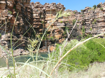
Port Lincoln is close to two large national parks, Coffin Bay National Park and Lincoln National Park, both with interesting walks and drives for visitors. Whalers Way is not a dedicated reserve but offers a most interesting drive through private land southwest of Port Lincoln. This is easily accessed with great coastal scenery from several lookouts. The area also has historic connections to Matthew Flinders and Nicolas Baudin and the whaling industry. Several remarkable geological features are found along the coast especially Theakstone Crevasse, the 120 m high calcarenite cliffs, as well as fascinating coloured rocks at Redbanks and at Cape Carnot on the most southerly part of the Peninsula.
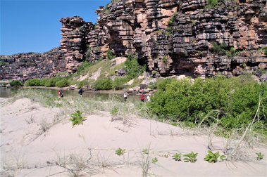
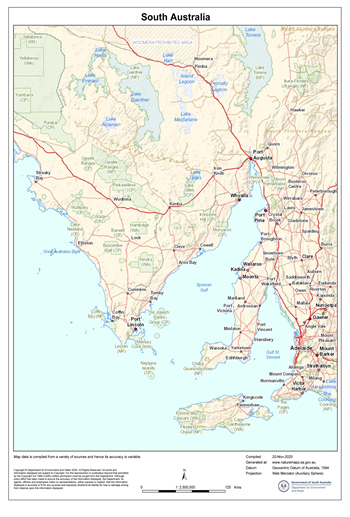
The rocks at Cape Carnot were once considered to be  the oldest rocks in South Australia (2.64 billion years old) -until the record was broken in 2008 by a find in the Middleback Ranges near Iron Knob at the north eastern corner of Eyre Peninsula. This new find recorded 3.15 billion years old.

Geologically this area is within the Gawler Craton and in 2008 geologists collected samples from granite on a transect located between Iron Knob and Iron Baron. Zircon crystals from the granite were recovered and subjected to an analysis technique known as Sensitive High-Resolution Ion Microprobe (SHRIMP), which measures the minute quantities of Uranium and Lead isotopes in the sample. These measurements enable geologists to determine the age of the mineral and in this case the age of the rock from which it came. To their great surprise the samples were dated to 3,150 Ma. Repeated testing produced the same result and so established that this was the oldest rock yet found on this side of the Continent. By way of comparison, the oldest rock in the world (from 4.28 Ma ago) comes from northern Quebec, Canada. In Western Australia at a location known as Jacks Hill zircon crystals have been dated at 4,400 Ma but given that the zircon came from a mixed gneiss sample, geologists considered it was not possible to say from exactly what type of rock it had originated from. 

Prospective minerals and metals in the Middleback Range include jade, marble, copper lead, zinc, uranium and manganese but only the iron ores found here are considered to be economically worth recovering. Iron Knob, the name of a township and an Iron ore mine in the Range is inland from Whyalla. Iron Knob mine is an open-cut pit mining two iron ores, magnetite and hematite.  The magnetite is smelted in Whyalla but the hematite is exported.  There are several other mine operations and potential mining sites along the range including one at Iron Baron. For most of this region rock formations were laid down over 2000 Ma under a shallow primeval sea.

Spencer Gulf, Gulf St Vincent and Yorke Peninsula

Spencer Gulf separates Eyre and Yorke Peninsulas, which is tidally influenced by the Southern Ocean but is fairly well protected from the wave generating westerly winds influencing wave generation on the Great Australian Bight coastline as experienced on the western side of Eyre Peninsula and the southern coastline of Kangaroo Island.

Just as Spencer Gulf had been named after a British Earl, Gulf St Vincent was also named by Flinders in 1802 after a British admiral who was the Earl of St Vincent. Gulf St Vincent is the smaller of the two and is connected to the Southern Ocean primarily by Investigator Strait and the much small Backstairs Passage at the eastern end of Kangaroo Island. Gulf St Vincent has Adelaide Plains on its northeast and the Fleurieu Peninsula to the south east.

A rare brick lighthouse at Troubridge Hill built in 1980 to replace the light on Troubridge Island. At south eastern ‘heel’ of Yorke Peninsula facing Investigator Strait, Kangaroo Island and Backstairs Passage.

In the 1840s prior to European settlement and reaching to the south of Yorke Peninsula there were four Traditional Owner clan groups of the Narungga people who occupied the Yorke Peninsula for thousands of years. They were the Kurnara of the north, the Windera of the east, the Wari of the West and the Dilpa (Dhilba) of the south. Guuranda.

Historic jetty at Stenhouse Bay -once a significant port for exporting gypsum. Innes National Park, Yorke Peninsula.

European settlers around the gulfs once relied on seaports for incoming goods, services and transport, along with the export of products like grain, wool, livestock and minerals. Commercial fishing was active in several locations and remains an important industry of the area. Road transport has essentially taken over most of these needs leaving just Port Lincoln, Whyalla and Port Pirie as functioning commercial ports today on Eyre Peninsula and the upper Spencer Gulf. Around Spencer Gulf there are a few ports specialising in a single export function. Ardrossan, Wallaroo and Port Giles are wheat handling ports; Turton and Port Broughton are used by the fishing boats; and Klein Point is used specifically for the limestone being shipped to Adelaide for cement production.

Like most of Eyre Peninsula, cropping is a major rural activity on Yorke Peninsula with wheat, canola, barley and lentils being the most common grain crops, with many hectares also being devoted to hay and pasture production.

Given that South Australia is the Continent’s driest state it is not surprising that catchment dams for domestic supplies would be quite unreliable. To overcome this problem water had been pumped from the Murray River at either Morgan or Swan Reach west to Yorke and Eyre peninsulas. One of the early pipelines (1940) was the Morgan -Whyalla connection to enable a reliable supply of water for steel production. Since then other Murray River water pipelines have been constructed with extensions to many towns and properties on both Peninsulas and elsewhere in South Australia. For some time Eyre Peninsula had relied on winter rainfall catchment reservoirs (e.g. Tod) and underground resources with some quite simple water catchment systems built around bare granite slopes to harness runoff as seen near Minnipa and Wudinna in the northern Eyre Peninsula.

Main pipelines from the Murray River; note that this water may supplement local supplies in some localities from underground water, natural run-off and desalination plants. The Flinders News, Port Pirie. (Source Wikipedia Commons).

Ores and Minerals

The north and western part of South Australia has considerable mineral wealth mainly due to is connection with the Gawler Craton. The most prominent of these are the Iron ore resources from Middleback Range with Copper, Uranium, Silver and Gold as mined at Olympic Dam at the northern end of the Craton. Outside the craton’s influence.

Burra was a major copper ore producer after its discovery in 1845 until 1977 and in the Kadina-Wallaroo-Moonta area copper ore was discovered in 1860-61. This latter area is often referred to as the ‘copper triangle’, ‘copper coast’ or ‘little Cornwall’ because of the number of emigrant Cornish miners who originally worked in the area. The copper ore was smelted at Wallaroo and easily exported from the local port. Port Pirie lead smelter is a major ongoing plant and has been active since 1880 treating not locally sourced ore but that brought in by rail over the SA border from Broken Hill in New South Wales.

While not an ore, Gypsum has been mined at several locations on both Eyre and Yorke Peninsulas and this continues as an export product from Lake MacDonnell near Ceduna. In the 1880s gypsum was discovered and mined at the southern tip of Yorke Peninsula and many remnants of the original industry are now ‘preserved’ in Dhilba Guuranda-Innes National Park. The jetty in Stenhouse Bay, now heritage listed, was originally used to export bags of gypsum.

Looking over white cliff-top sand at the Aeolianite/Calcarenite Cliffs, Dhilba Guuranda-Innes National Park
Lighthouse at Cape Spencer the most southern point on the Peninsula looking toward Seal Island. Dhilba Guuranda-Innes National Park, Yorke Peninsula.

Dhilba Guuranda-Innes National Park also takes in a wide variety of spectacular coastal scenery, a lighthouse and inland mallee woodlands which provide habitat for a range of endangered bird species including the malleefowl. The tammar wallaby that had become extinct on the mainland since 1920, was successfully re- introduced to the park in 2004 from the offspring of animals re-introduced to Australia from New Zealand.  The name of the park has recently changed from Innes National Park in acknowledgment  of the traditional owners of this area and their role in joint management of the Park.