Flinders Ranges, South Australia – Background briefing landscapes and natural history

Background briefing – The Flinders Ranges, South Australia Notes for travellers on the landscapes and natural history #4

Flinders Ranges- European discovery and naming 
Rocks and Landforms -old and diverse
Drive through Brachina Gorge -a journey in time

Fossils
Modern Plants and Animals in the Flinders
Arkaroola and the Gammon Range
A W (Sandy) Scott. Nov. 2020

Inland from the Fleurieu, Yorke and Eyre Peninsulas of South Australia are two interesting travel destinations that have qualities attractive to nature loving adventurers and to geologists. In the west are the Gawler Ranges and in the east are the Flinders Ranges, and the latter are the focus of this article.

Southern South Australia showing Eyre, Yorke and Fleurieu Peninsulas (EP, YP & FP) along with the Gawler Ranges (GR) and the Flinders Ranges (FR) Map prepared by DEW, Mapland, South Australia. Nov. 2020

Flinders Ranges- European discovery and naming 

The Flinders Ranges were named after Matthew Flinders during his sea survey explorations along the south coast of Australia in 1802. In Investigator Flinders sailed to the north of Spencer Gulf, about 30 km south current Port Augusta and realising the Gulf was narrowing and getting shallower anchored in Yatala Harbour. Next day a shore party, led by his naturalist/botanist Robert Brown, along with landscape artist William Westall, gardener Peter Good, illustrator Ferdinand Bauer, geologist John Allen and two servants walked northward over the hills to climb what was later named by Flinders, Mount Brown (960 m). 

From this point near the southern end of the Flinders Ranges, Brown would have observed the high country to his east continued to the north but unlike the Adnyamathanha traditional owners of this hill country, neither he nor the rest of the shore party would have had any idea of their total extent. In fact, we now know that this string of mountain ranges extends over 400 km from north to south. In a report, published 1839, State Governor George Gawler referred to these ranges as, ‘Flinders Ranges’, a feature now very well-known and regularly visited by South Australians and on the ‘wish-list’ for many other travellers from further afield.

While Brown walked inland, Flinders travelled by cutter with his surgeon Hugh Bell to explore locations at the head of Spencer Gulf. They spent overnight just short of the present location of Port Augusta and next morning they progressed north until the boat men’s ores could touch the side of the channel -they had arrived at the head of Spencer Gulf.

Today this point appears to be about 10km north of Port Augusta. A little south of this point Flinders stopped to take compass bearings, and one of his key points was Mount Arden (839m), north-northeast of their current position on the western side of the Flinders Ranges and almost due north of Mount Brown.

Rocks and Landforms -old and diverse

The rock formations in Flinders Ranges, like the Mount Lofty Ranges to their south, began within an extended period (870 Ma (million years ago) to about 500 Ma) over which several types of sediments were deposited in shallow waters by rivers in a series of slowly sinking shallow troughs. Over time the compressed sediments became the sandstone, quartzite, limestone, siltstone and mudstone, rocks we see making up the ranges formation today.

Subsequent earth movements pushed the sedimentary rock formations from their original horizontal position upwards with much fracturing and folding of the rock to form hills and valleys. Once exposed, weathering and erosion removed the less resistant rocks like siltstone leaving the formations of harder sandstones and quartzite. It is the latter rock types that are most visible where they protrude as ridges and crags or get exposed following creek bank erosion. Valleys have often developed where the ’softer’ sediments were once found.

Folding occurs when earth movements compress the formations horizontally to form wave like patterns with crests (anticlines) and troughs(synclines). The syncline that forms the magnificent feature Wilpena Pound, is dish shaped and several kilometres across. On a much smaller scale we also see folded rock with just metres between successive anticlines.
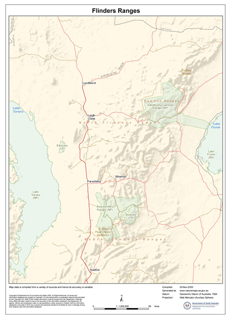
Flinders Ranges located between Lake Frome to the east and Lake Torrens to the west. Map prepared by DEW, Mapland, South Australia. Nov. 2020
L. A series of anticlines and synclines;
R. A syncline and landforms
Wilpena Pound, view from Wangara Lookout, Ikara-Flinders Ranges National Park. This dish-like landform is a syncline and the rising sides encircling the Pound were once part of the anticline, now removed by weathering and erosion.

Folding has been a most important process in the origin of many local landforms with several of the fractured upswept masses becoming cliffs at the top of ridges as in the Flinders’ Great Wall of China.

The cliff top, Great Wall of China, Ikara-Flinders Ranges National Park
A typical cuesta with its gently sloping dip slope of ‘resistant’ sedimentary rock with the formation of an escarpment/cliff above the steeper side formed on the underlying ‘softer’ sedimentary rock. North of Brachina Gorge.

Earth movements producing faulting, may compress or stretch brittle rock formations resulting in joints that divide the original horizontally positioned rock strata into displaced blocks of rock with one side of the fault rising above an originally flat surface. Alternatively, the original formations may be subjected to sideways forces that move parts laterally horizontal with displacement along the fault line ranging from a few centimetres to many kilometres.

The two main types of faulting showing both vertical and horizontal movements/ (Wikipedia Commons)

Over time weathering, erosion and soil formation may mask past faulting but when recognised by a geologist is represented on maps as straight black lines. On the other hand with folded rocks, anticlines are indicated of a map as a pair of arrows pointing in opposite directions and synclines as two arrows pointing toward each other.

Drive through Brachina Gorge -a journey in time.

Driving along Brachina Gorge displays many of the physical features mentioned above and folding has exposed a sequence of 17 different rock formations by tilting them from a horizontal position with the youngest formations at the top in the west and successively older formations beneath.

When travelling from east to west all 17 tilted formations are crossed beginning at the eastern end with the oldest, Precambrian rock, and ending with a limestone from the Cambrian Period formed 130 Ma later. Explanatory interpretation boards along the way name and describe the diverse formations.

One of the many interpretation notices along Brachina Gorge.

The gorge has been cut down through the weathering and erosion actions of Brachina and several smaller creeks with the eroded sediments being carried westward out of the gorge and across the slopes toward Lake Torrens. In many cases the direction of the creek is influenced by the resistance of rock to weathering -with the most resistant formations causing the creek to change direction. During the hotter seasons the bed of the creek (which serves as the road in places) is generally dry.

Fossils

Two of the rock formations in Brachina Gorge bear fossils of great age. The oldest of these are Stromatolites a life form that grew as thin films of Cyanobacteria, bacteria like organisms, that lived in shallow saline sea and able to carry out photosynthesis. The films of cells collect and bind with sediments to forms multilayers that build up over 1,000s of years and depending on the species of Cyanobacteria involved, form a solid cemented flat, cone shaped or dome like structures.

While these particular Stromatolite fossils lived less than 1,000 Ma (Millions of years ago)  older members of this group, found elsewhere, are known to have been 2,500 Ma old making them one of the earliest organisms. Their significance does not end there.  Photosynthesis results in the-production of Oxygen and over the millions of years Stromatolites oxygenated the water. Once saturated oxygen  ‘escaped’ for the water to  the atmosphere so providing a habitat suitable for a new suite of organisms -the aerobes.  Aerobes are organisms that survive and grow in an oxygenated environment.

Conical fossil stromatolites from ca. 1650 Ma. Abner Range, West of Cape Crawford, Northern Territory.

Modern day relatives of these Stromatolite species are found in shallow hypersaline waters that are also very rich in calcium carbonate leached from the local sand that is itself carbonate rich. The best known stromatolites are those in Hamlin Pool at the southern tip of Shark Bay.

Stromatolites in Hamlin Pool, Shark Bay, Western Australia. The distant beach is dominated from calcium carbonate rich sand.
A close image of the multilayers of a dome-shaped Stromatolite fossil, Brachina Gorge.

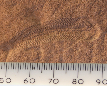
The other set of local fossils of note along Brachina Gorge are the Ediacaran group, the world’s first complex multicellular animal life with specialised tissue. These fossils formed as casts on the surface of stromatolite mats and are most numerous in the last phase of the Neoproterozoic Era, the recently named Ediacaran Period lasting from 635 Ma to 541 Ma. Early studies believed that their soft bodies bodies were preserved as fossils by being enclosed in fine sediments however the details of their fossilisation is far from settled.

Ediacaran species vary in shape and oval ones may range in diameter from 1 to 70 cm. Species are relatively wide-spread and found as fossils in Russia, Canada, Mexico, England and Ireland. They were first discovered by South Australian geologist Reg Sprigg in 1946 and have been named after the Ediacaran Hills on the western side of the north Flinders Ranges where Reg made the discovery of what he initially thought was a sea jelly (jellyfish) fossils. The rock bearing these fossils is also found in the Flinders Ranges and is known as the Trezona Formation. It is exposed in Brachina Gorge and reveals Ediacaran fossils.  

Dickinsonia costata, an Ediacaran organism
Spriggina, another Ediacaran genus, may be one of the predators that led to the demise of the Ediacaran fauna.(Wikipedia Commons).

A Golden Spike is ‘(a) geologic marker created by a global event that leads to long lasting global changes recorded in the geologic record that can be used to indicate a change in a geologic time division such as an epoch, age, era.’ (Wikipedia Commons). One of these spikes is found in the Flinders Ranges indicating the geological importance of this discovery.

This ‘spike’ is the 64th in the World, it marks the discovery of the rock strata in which Ediacarans are found and what is now recognised as Ediacaran Period from 635 Ma to 541 Ma.  The spike was embedded near Ediacaran fossils along Trezona Creek, off the Brachina Gorge Road in the Flinders Ranges in 2004. South Australia may therefore claim this as a ‘First’ for itself, Australia and the Southern Hemisphere given that most other similar geological events (e.g. for the Jurassic, Ordovician, Cambrian and Devonian Periods ) were over a century ago in Europe, Britain and north America when identifying newly found rock formations and their fossils.

A wide range of Ediacaran species were also discovered on Nilpena Station south of the Ediacara Hills (a western outlier of the Flinders Ranges). Very recently some 60,000 ha of this property was purchased through South Australian Government sources and private donations and this has been set aside as the Ediacara Conservation Park (and hopefully out of reach of illegal fossil hunters). This site is currently under scientific investigation and may only be visited in organised groups.
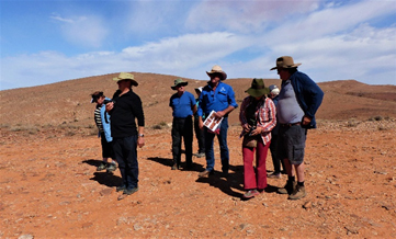
Group about to visit the fossil site on Nilpena Station with property owner and guide Ross Fargher.

Modern Plants and Animals in the Flinders

The landscape diversity in the Flinders has resulted in a great variety of plant communities. The mostly dry creeks for example are lined with huge river red gums or upland woodlands of cypress pine. While the National Parks generally support natural plant and animal communities many other parts of the Flinders Ranges have been cleared and used for sheep grazing.

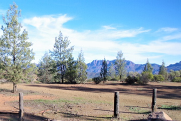
River red gums (Eucalyptus camaldulensis) roadside above Brachina Creek.
White Cypress-pine (Callitris glaucophylla), Bunyeroo Valley Lookout.
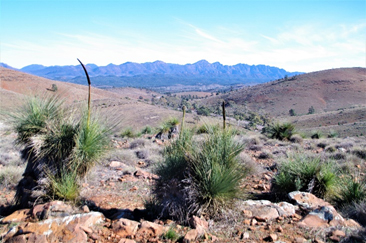
Grass trees (Xanthorrhoea quadrangulata) on stony hillside in Ikara-Flinders Ranges National Park

Following winter rain hectares of land in Ikara-Flinders Ranges National Park is often covered with masses of blue flowered salvation Jane (Echium plantagineum) , an introduced plant usually considered to be a weed and so it is given its alternate common name, Patterson’s curse. The natural vegetation of the floor of Wilpena Pound, a well visited site in the south of the Park, is dominated by a low woodland of White Cypress-pine and Eucalyptus intertexta, commonly known as gum-barked coolabah, with many other understory shrubs and herbs including salvation Jane. Most of the native plants have regenerated since sheep grazing and cropping ceased within the Pound and more generally within the Park as a whole.

Emus and red and grey kangaroos are plentiful on the grassy plains, euros (hill wallaroos) on rocky outcrops and flocks birds like galahs and white corellas are common. Beside these more common species the yellow-footed rock-wallaby may be spotted high up rocky crags and there are many smaller bird species and reptiles for those willing to sit and look.

Arkaroola and the Gammon Ranges

Within the main section of the Flinders Ranges, Blinman is the main central settlement, Hawker is to the south and Arkaroola is in the north Flinders. The Ikara-Flinders Ranges National Park in the central-north of the Ranges has a large campground and resort and its most popular attraction, Wilpena Pound, in at its southern end. Ransley Park Station, another well visited centre is just outside the park to its south.

Like the other settlements Arkaroola is a popular destination for travellers and has many attractions related to wildlife, astronomy, mining history with several interesting drive and walking opportunities. This northern section of the Flinders Ranges is often referred to as the Gammon Ranges, and the Vulkathunha-Gammon Ranges National Park is just to the south of Arkaroola.
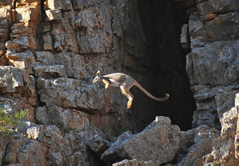
Yellow-footed rock wallaby (Petrogale xanthopus) in its normal habitat, Flinders Ranges. Australian Wildlife Conservancy (Wikipedia Commons).
Gammon Ranges in the northern Flinders Ranges and Arkaroola Prepared by DEW, Mapland, South Australia (Nov. 2020)

Arkaroola was bought as a property by Reg Sprigg and family with the aim of creating a wilderness sanctuary. About the time of purchase (1968) feral goats were numerous and a threat to the yellow-footed rock wallaby. The goats lived on similar shrub and grasses to the wallaby and sheltered in the caves and overhangs of rocky outcrops the wallabies used as their cool daytime retreats. At the time of purchase feral donkeys and camels were also common in the area, foxes were numerous along with feral cats. Foxes and cats posed a direct threat particularly to young wallabies.

Fencing and elimination of the large mammals was successful with poisoning and shooting to reduce fox and cat numbers.  Regaining their habitats and the removal of predators has allowed the rock wallaby to resume its habitats on Arkaroola. A depletion of foxes and feral cat numbers help reduce the threat to other small mammals like several bat species, species of the dunnart (a small carnivorous marsupial), smaller reptiles and many bird species.

For the visitor there are accommodated and camping facilities and many spectacular hill-top views including those across to Lake Frome. There are hot springs at Paralana north of Arkaroola and their Radium content indicates the presence of radioactive minerals. Geologists believe Uranium from here was leached from its source and accumulated in ancient drainage channels in economic proportions away from the hills. This is now extracted at the Beverley Mine located east of the hilly country about 35 km from Arkaroola. Here the mineral is brough to the surface, not through digging, but pumped in an acid solution from which the ore may be then extracted.

Copper mining and processing also occurred just west of Arkaroola and the industrial ruins may be visited to see the two brick furnaces in which the copper ore was smelted at Bolla Bollana in the mid-1870s.

Spinifex and spinifex – Background briefing for travellers in Australia

Spinifex and Spinifex

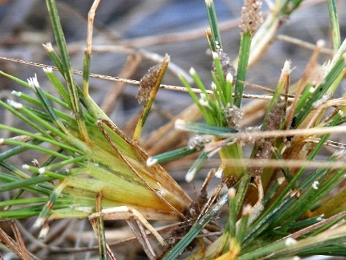
P1020087 (2)
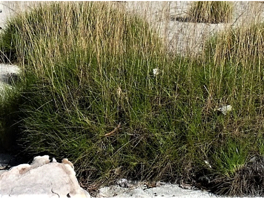
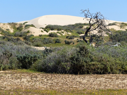
Hummocks of Triodia sp. on the sand dune above the tidal lake, East Vansittart Bay, Kimberley, W.A.
Most Travellers in Australia encounter a new range of plants once they move out of their own familiar surroundings. This article has drawn together bits and pieces of information about Spinifex and Spinifex plant groups in the hope that some of the misunderstandings and complexity about Australian plant diversity is simplified.
Spinifex and Spinifex

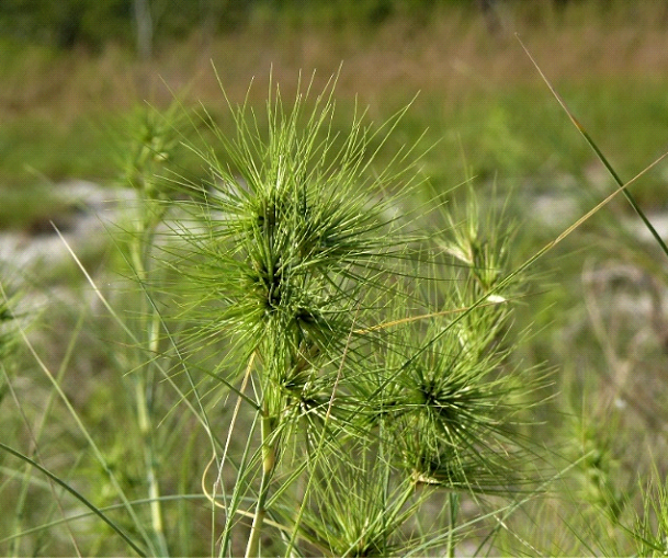
Spinifex may be a confusing name since Spinifex is the generic name for example of the hairy and the long leafed spinifex, a grass that trails over the dunes behind the beach. Spinifex (not including italics) is the common name for a group of porcupine grasses that often grow as hummocks.

Spinifex-the genus

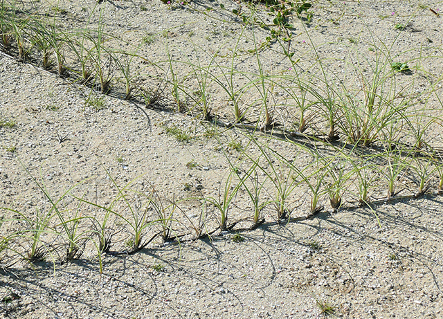
In southern Australia hairy spinifex, Spinifex hirsutus predominates and in the north a long-leafed species, S. longifolius is common in sandy beach environments.

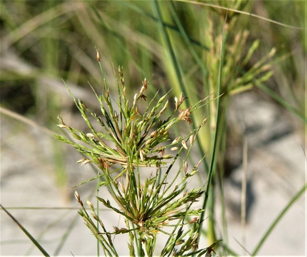
Interestingly these Spinifex species have both male and female plants. They look to be the same except at flowering when the male inflorescence is smaller than that of the female. At maturity the female plants produce a ball-like structure about the size of a baseball that once mature breaks away from the parent and may be rolled around by the wind so spreading the seeds held with it. Spinifex produces long stoloniferous shoots that spread over the sand with roots developing from some of the nodes (swelling along the stem). In total these sand-binding plants tend to stabilise the windblown sand of the dunes.

Spinifex longifolius from hind beach on mainland, west of Winyalkan Island, Kimberley WA.
Note the many shoots arising from a horizontal stolon/rhizome that spreads the plant
and sends down roots that help stabilise sand movement.

Male flowers of Spinifex longifolius
Female flowers head of Spinifex longifolius

Spinifex -the common name

Spinifex is used as the common name for arid and semi-arid plants mostly in the genus Triodia along with a few in the closely related genus Plectrachne. In central Australia there are ten Triodia species and four in Plectrachne but when we include all Australian habitats we find there are 35 species of Triodia and 10 Plectrachne for this group of endemic species.

As a moisture conserving adaptation, several species of Triodia roll up along the midline of their upright leaves. These become stiff and the folding protects the surface of the leaf bearing the leaf pores, the stomates. The ends of these leaves may be quite pointed and sharp and were complained about by many of the inland explorers who were not ready for this assault on their legs. It is this characteristic that has led to suggestions that ‘porcupine grass’ may be a more apt as a common name than ‘spinifex’. With some exceptions this type of leaf is not attractive to most herbivores and their spiny nature offers protection to small mammals that live under the plant. Much of the leaf stiffness is due to the presence of silica either incorporated in the walls of some of the epidermal (surface) cells or as cells with microscopic concentrations of silica referred to as silica bodies. It is possible to find small plants amongst the larger plants that are constantly grazed by animals such as the short-eared rock wallaby. It would appear that these animals are nibbling on young leaves and not the older (tougher?) leaves.

(L) Hummock of T. microstachya and (R) close up of their flower stems
and the short pointy green leaf base. Wary Bay, Bigge Island, Kimberley WA.

A well grazed hummock of Triodia sp. Note the many tell-tale scats
of the short-eared rock wallaby. Mainland west of Winyalkan Island, Kimberley WA.

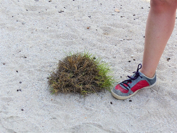
Many of these species form hummocks (i.e. little rounded hills) as they grow rather than tussocks, or runners, a more common growth pattern in other grass species. In the arid zone the hummock grasses (mainly Triodia spp.) make up 31% of the area. Of course they are not limited to arid zone and as seen in the examples used in this article Triodia species seem well adapted to parts of the wet and dry tropics in northern Australia especially growing in well drained sandy and rocky habitats.

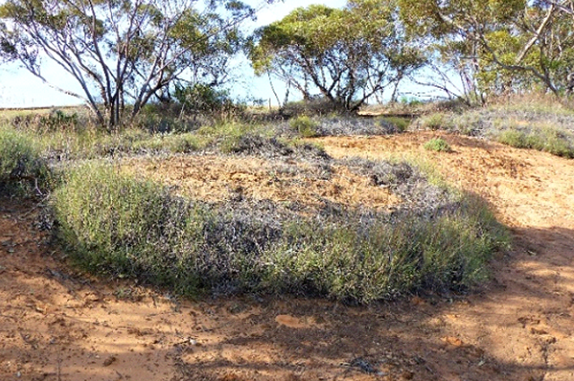
As the plants age growth continues outward from the hummock base and eventually the centre of the plants dies. It is this phenomenon that leads to the production of circular plants with growth at their perimeter but the centre of the ring has the dead remnants of earlier growth. The rings often with complete perimeters may reach 10s of metres across.

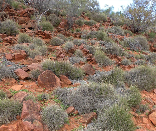
Hummocks of Triodia sp. Gawler Ranges National Park

Rings of Triodia sp. hummocks, (L) roadside north of Karoonda, SA.
(R) Sand plain Wary Bay, Bigge Island, Kimberley WA.

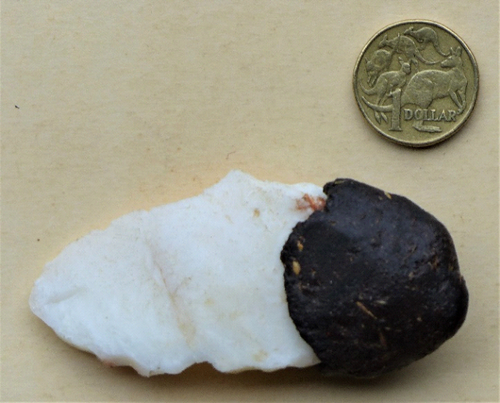
Central Australian Aboriginal quartz scraper with a Triodia sp. resin ‘handle’.
(Scale Aus$1 coin.)

Several of the porcupine grass species produce a gummy resin on their leaves which may be felt and smelt. In these species the gum accumulates as a solid mass at the base of the leaves over time and becomes particularly obvious after the plants have been burnt. This material is a mixture if the gum and pieces of the stem and is collected by Aboriginal people and used the attach tips to spears, to form the smooth section of a stone knife and scrapers and for example to patch holes in a coolamon, the multipurpose carrying vessel.

The value of this material is it has thermosetting properties and is soft and pliable when heated up but hard at ambient temperatures. The resinous leaves make clumps of this species quite flammable and when burnt it issues a black smoke and is reported as an Aboriginal signalling device.

An interesting find

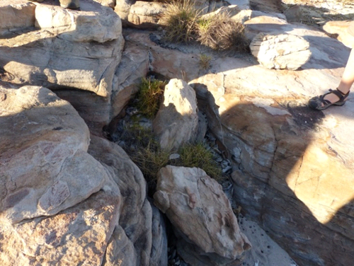
While most of the porcupine grass on Bigge Island on the Kimberley coast WA grows on the sandy sections, I have found one area between the sandstone rocks where the Triodia sp. plants are not rounded hummocks of porcupine grass but chewed off plants with most green shoots less than 10cm high. The tips of fresh growth are likely to be grazed by Monjon (Petrogale burbidgei) a small rock wallaby that lives on the island. Over the rock and bare sand there are also tunnels constructed by spinifex ants (Ochetellus flavipes) that use the resin produced by the grass to stick the sand together. The tunnel runways also extend to the plants many of which have cylinders of sand grains, also constructed by the ants, attached to their stems. Within these cylinders that the ants tend sap-sucking mealybugs that produce honey dew that is then consumed by the ants. This mutualistic relationship between the ant and the bug is limited to the fresh shoots of the stunted Triodia. But there are other interesting relationships to consider including the herbivorous consumer Monjon and the producer Triodia, the constructing and consuming spinifex ants and the mealybugs that parasitise the plant!

Five grazed Triodia sp. plants and the spinifex ant tunnel runways seen to the left
of the sandal. Rock platform north side of Wary Bay, Bigge Island, Kimberley WA
Grazed off tips of the Triodia sp.with distinguisable mealybug sand-cylinders mid-top. Rock platform north side of Wary Bay, Bigge Island, Kimberley WA.

Acacia – Background briefing for travellers in Australia

Acacia

image003
Golden Wattle, Australia's National Floral Symbol
(Source: Wikipedia Commons)

Most Travellers in Australia encounter a new range of plants once they move out of their own familiar surroundings. This article has drawn together bits and pieces of information about Acacia/Wattle plant groups in the hope that some of the misunderstandings and complexity about Australian plant diversity is simplified.

Acacia is Australia’s largest plant genus and the 1000-odd Acacia species are referred to as wattles. The golden wattle (A. pycnantha) is the Australian National Flower and Australia wide, Acacia’s run second to Eucalypts as having the most forest and woodland trees. In the arid zone Acacia shrublands make up 33% of the area.

When not flowering many Acacia species are distinguished by their leaf shape. Some species such as Cootamundra wattle, Acacia baileyana, retain the true leaf shape that is evident in the seedling stage. These species do not have a single entire leaf blade (the lamina) like an apple tree, but a compound bipinnate one where the lamina is twice divided into small leaflets call pinnules. This unit is attached to the branches with a stalk called the petiole

Acacia

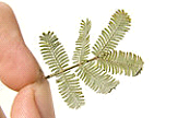
The bipinnate leaf of Cootamundra wattle, Acacia baileyana.

The bipinnate leaf of Cootamundra wattle, Acacia baileyana.
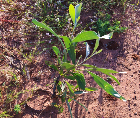
However, for the majority of Acacia species it is the leaf stalk (the petiole) that develops without the formation of a leaf blade and this serves as the main photosynthesising part of the plant. The flattened petioles are called phyllodes, they can be of many shapes and sizes and the majority have what are referred to as nerves (not veins) running along them. Most species have between one and five prominent nerves on their phyllodes but mulga, A. anura as suggested by the Latinised specific epithet anura (’a’ not; ’neura’ nerve), has thin phyllodes without a prominent nerves.

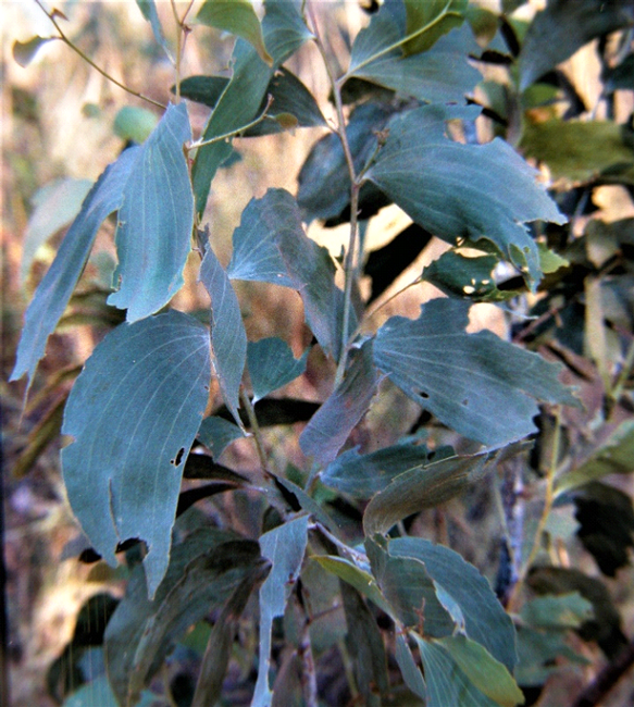
Well chewed large phyllodes of candelabra wattle (Acacia holosericea), east Kimberley, WA. Note the four prominent nerves and the blue grey colour typical for this species.

In their seeding stage most phyllode bearing wattles develop small bipinnate leaves at the tip of a broad stalk, the petiole. However in subsequent development only of the flattened petioles, then known as phyllodes are evident without a bipinnate lamina on all future growth of the foliage

Occasionally leaves and phyllodes may have spines on the stem located below leaves or phyllodes. In fact, the generic name Acacia is Latin is the Greek word for ‘thorn’. This arose given it was a characteristic of the Type plant, Acacia niloctic, the prickly acacia from Africa was the first species to be scientifically described. This is not a characteristic feature of most Australian endemic species, but A. victoriae, the bramble acacia, common in arid and semi-arid habitats, is one endemic thorny species and is often used by birds, lizards and small mammals for protection from predators.

It is believed that phyllodes are an adaptation to dry conditions where phyllodes function more efficiently than leaves with respect to moisture use via transpiration. The upright phyllodes of mulga, another wattle from arid and semi-arid habitats is an adaptation that reduces the midday radiation exposure and could therefore reduce heat stress and loss of water via transpiration. This upright arrangement of phyllodes also serves to channel rainwater from it canopy towards the trunk where it runs to the base of the plant. One calculation assessing the efficiency of this arrangement suggests this increases usable water to the roots three-fold.

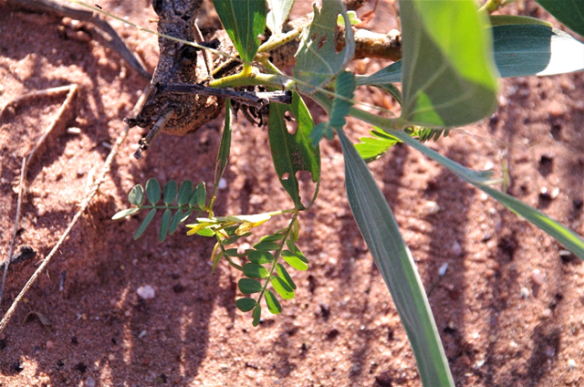
Acacia seedlings and the change with age from bipinnate leaves
with thin phyllodes and their replacement to broad phyllodes

And finally, two other adaptations to arid conditions: mulga has a very deep root system and plants under stress from drought conditions will begin to drop their phyllodes.
Many areas of inland Australia once covered by mulga are now bare of the species with only a scattering of old dead trunks to indicate their past presence. One of the main contributors to this situation is related to their seedlings being vulnerable to the high grazing pressure often inflicted by sheep or rabbits. This factor along with a fairly precise sequence of climatic events necessary for seeding establishment has led to the general demise of mulga.
Wattles are found in most habitats of Australia from alpine heights, the edges of rainforests and across the broad reaches of semi-arid and arid country. Brigalow (A. harpophylla), grew in extensive communities in inland south eastern Queensland and northern New South Wales but due to the favourable soil and rainfall regimes in which it grew the area has been extensively cleared in favour of broad-acre farming cropping.
Many wattle species and varieties have been selected as suitable garden plants and while gardeners generally appreciate their rapid early growth they are disappointed that most species have lifespans less than two decades. This feature contrasts with mulga (A. aneura), a species that has been reported, in the absence of fire, as having a 200 to 300year lifespan. Another of the many drought tolerant Acacias is A. peuce, Birdsville wattle or waddi wood. A small copse of this endangered species found just north of Birdsville in arid southern western Queensland. Like mulga waddi wood may live up to 200 years.
As noted above mulga a very widespread with its densest distribution on nutrient poor soils in arid habitats. Through natural selection at least nine varieties of this species are recognised. Comparative studies on these varieties are likely to demonstrate adaptive differences that are related to the specific habitats conditions in which they naturally grow. A general characteristic of varieties within a species is that they are capable of successfully interbreeding. However, with A.aneura some taxonomists are suggesting that several varieties are so different from the typical mulga that these varieties should be considered as distinct (new) species in their own right.

A lone mulga shrub growing in the stony capping rock, at Kanki – Breakways Conservation Park,
north of Coober Pedy. One way to recognise Acacia aneura is the fact that
its phyllodes are erect (point upwards), a feature visible in the image.

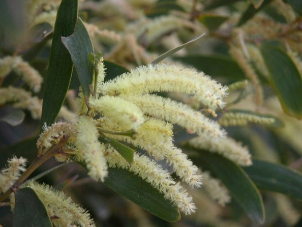
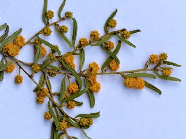
We usually recognise wattle by their fluffy yellow blossoms. Unlike many other plants that gain their floral colour from their petals, wattle flowers have tiny petals and their colour is via their masses of stamens that are in most species yellow. The individual flowers are very small and masses of them are arranged either as spheres or as a cylinder. After successful pollination some of the flowers will develop pods containing seed, pods that hang from the matured flower before splitting open to release its seed.

(L)An Acacia species with cylindrical arrangement of the flowers. Wilson’s Headland, N. Wooli in Yuraygir National Park, NSW
(R) A. aneura flowering with many mostly unopened spherical bundles of buds. Coober Pedy, SA.

All wattles fall within a group that have legume like characteristics. Not only do they have pod that splits open when dry to disperse seeds, but they also develop rhizomes on their roots. Specific soil bacteria, Rhizobium, cause legumes to form these rhizome swellings on their roots that are capable of converting nitrogen in the soil air into chemically fixed nitrogen rich compounds within the rhizome. This nitrogen source benefits the plant given that the soils they often grow in are nitrogen poor, such as hind dune sand on beaches, and that these compounds are essential for protein production. This feature enables wattles to colonise nutrient depauperate habitats like the lighter textured sandy soils in the arid area. When the plant dies or the root ages, the rhizome and the protein rich plant parts break down releasing the nitrogen compounds into the soil and of course the seed of legumes including beans, peas and other lentils tend to have high protein levels. It is not surprising that the seed of several wattles are collected, and ground to a flour and prepared as one of the seasonal diet components of many Australian Indigenous clans.

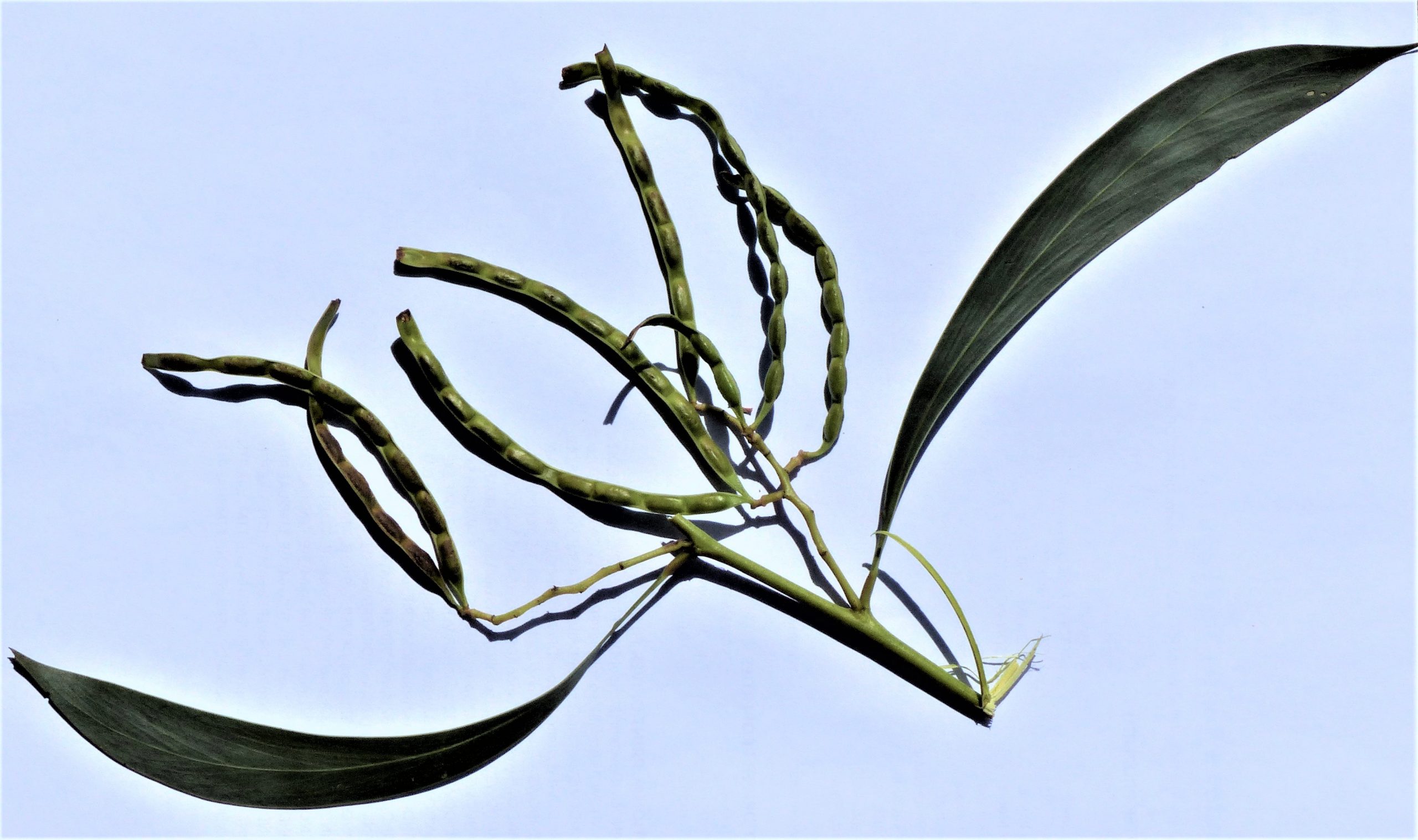
Pod of wattle filled with seed. Pods average 8 cm long and the longest phyllode is 16 cm long.

Eucalypts – Background briefing for travellers in Australia

Eucalypts

b1
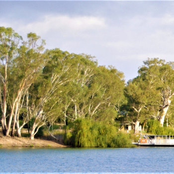
River red gums, E. camaldulensis, on the Murray River Morgan, SA
Most Travellers in Australia encounter a new range of plants once they move out of their own familiar surroundings. This article has drawn together bits and pieces of information about the Eucalypt plant groups in the hope that some of the misunderstandings and complexity about Australian plant diversity is simplified.

What’s in a name

Let’s start with names. Whether it’s names on a plant nursery label or an interpretation brochure in a national park for the dominant species, there is often a common name and some hard to pronounce name written in Latin for each. The name in Latin is the scientific name it has two parts and is called the species binomial. First is the generic name the second is the species name. Technically this second name is known as the specific epithet. There are no such binding rules for common names although some interest groups like Birds Australia do have a set of acceptable common names.

Jarrah, the common name for a tree from south western, Western Australia is Eucalyptus marginata. Some points to note about this name: an organism, may have multiple common names but only a single scientific name where the genus, Eucalyptus begins with a capital letter and the specific epithet, marginata begins with a lower case letter. Note that both names are in italics because they are written in Latin, a language other than English. It wouldn’t matter if you were to read about this species in an article written in Greek or Arabic script, any reference to the scientific name of an organism will be written in Latin. If you were to flick through a Russian botany book any references to species stands out within the Cyrillic text! Note that once a scientific name has been spelt out in an article, subsequent reference to this species may reduce the genus to a capital as in E. marginata.

While there is only one species called E. marginata, the genus Eucalyptus has some 700 other species. Eucalyptus and its two close relatives Corymbia and Angophora have a total close to 900 species and along with several other genera belong in Family Myrtaceae. To summaries the hierarchy -Species belong in a Genus and several genera make up a Family. There are several other ascending categories in the hierarchy such as Order, Class and Kingdom. In some cases, specimens of a species may be identified as a sub species (abbreviated as spp.), varieties, breeds (as in crop plants or farm animals) or ecotypes -each name is describing a genetically determined variant within a species.

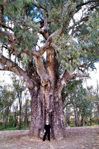
One of the common Eucalypt species is the river red gum, E. camaldulensis and it takes its name from two sources. Eucalyptus has a Greek origin meaning ‘well covered’ and refers to the caps on the flower buds, the operculum. However, ‘camaldulensis’ has a more interesting derivation. Seed of this species were taken from Australia in the early 1800s to Italy to be grown in swampy areas to help reduce surface water, so preventing the reproduction of mosquitoes. In turn, this was aimed at reducing the local malaria problem. One of these river red gums ended up in a garden near Naples -L’Hortus Camaldulensis di Napoli-, and when the species was first scientifically described, the name was based on the source of the specimen – the Camaldoli garden. So, the mostly widely distributed Eucalyptus species in Australia, found along many river banks, has an Italian name!

A giant river red gum with a relatively short bole and a deep canopy, Ororoo, SA.

Some features of Eucalypts

With just a few exceptions Eucalypts have a natural distribution limited to Australia but it happens to be the most widely distributed hardwood planted around the world. As woody plants Eucalypts may vary in size from low growing shrubs to towering forest trees. Forest tree species tend to have a bole (the trunk of a tree up to the branches) that is much higher than the depth of the canopy. By contrast in woodland communities the depth of the Eucalypts canopy is greater than the height of the bole.

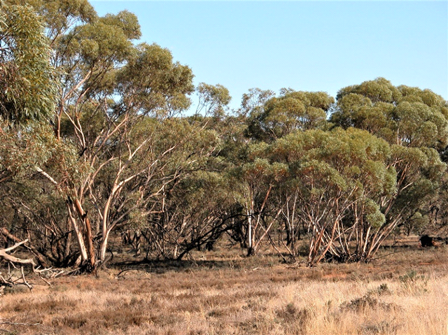
Mallee Eucalypts have an umbrella shaped canopy developed on multiple trunks that arise from a large underground wood base known as a lignotuber or mallee root. Growing 0.5 to 9 metres high, mallees are found as the dominant species in Mallee Shrubland commonly found in semi-arid environments across southern Australia. Within Australia there are some 80 million hectares of non-mallee Eucalypt forest and woodland, and 12 million hectares of multi-stemmed mallee.

A mallee community, western Riverina, NSW
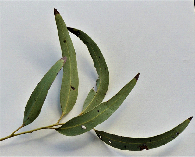
Lanceolate Eucalypt leaf sprig each leaf with
at least one imperfection.

An interesting story

In my days as a lecturer on Australian flora, after placing a $10 note as a reward on the front bench, I would challenge my students to bring me back an entire undamaged mature Eucalypt leaf after their morning-tea break. I did not every have to pay the reward. However, I would not have offered the same challenge to students when teaching at Arizona State University knowing that there were few natural ‘enemies’ of the many introduced Eucalypts trees growing in the University grounds at Tempe, Az!

Eucalypt Leaves

There is great diversity between species based on leaf characteristics such as length, width, shape of the tip and base, characteristics of the leaf veins and their colour. In most species the mature leaves hang with an isobilateral rather than a dorsiventral orientation. So rather than exposing a wide leaf blade surface face upwards to the sun’s radiation as with the dorsiventral orientation, only the edge of the leaf is exposed with the two large sides receiving most radiation early and late in the day.

However, in their juvenile stages many Eucalypt species do have broad dorsiventral leaves possibly as an adaptation to make rapid growth and so reach a better illuminated situation ahead of their competitors. Juvenile leaves tend to be quite ovate in shape compared to lanceolate in the adult stage and differ from mature leaves in their colour. In some species the juvenile leaves are stemless and may actually clasp the stem.

Except in immature leaves it is difficult in Australian conditions to find a mature Eucalypt leaf that is not partly chewed away, punctured by a leaf sucking insect or playing host to a leaf miner, a scale insect or a batch of insect eggs.

Bark Types

One of the common ways to distinguish Eucalypts is based on the nature of their bark. Some species have smooth trunks and branches and any bark that is shed during growth is not persistent and falls away from the tree, such species are usually described a gums.

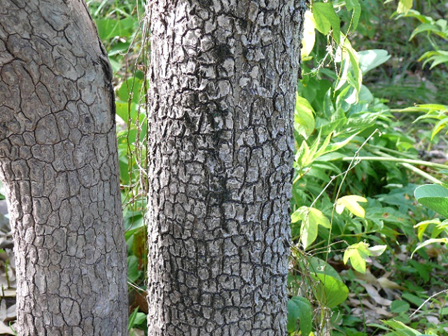
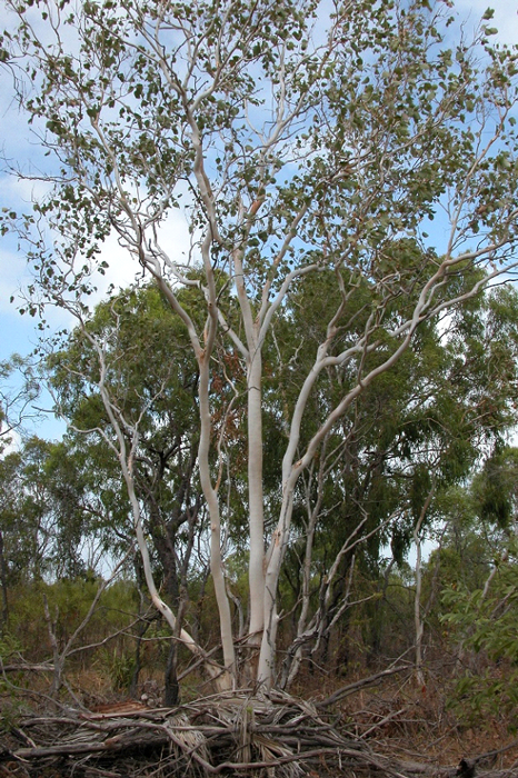
Others with smooth bark may have bark that may falls away or hang in the tree as long ribbons (the ribbon-barks). These smooth barked trees vary from stark white (eg ghost gums), patchy green and grey to the pink salmon gums. Those with a minnerichi bark are a smooth coppery red beneath thin shedding bark that tends to have curled up ends. Iron barks are often quite dark and retain their persistent hard, thick and furrowed bark. Stringy barks have rough bark with shallow furrows and may be pulled off in fibrous strips. One group of species retain their rough bark as a covering part way up the bole (trunk) and are referred to as half barks. With E.miniata, the Darwin wollybutt for example, a species that grows across most of northern Australia, trees may have rough bark up to their lower branches and above these branches are generally smooth barked. By way of contrast, E. tessellaris, Moreton Bay ash, has tile-like bark on the bole that forms a distinctive collar below the grey or white smooth bark above.

Several of the species referred to as bloodwoods, also have this tessellated bark. Strictly speaking, many of the gums, and the bloodwoods having a slightly different floral structure to Eucalyptus due to differences in the structure of their anthers so belong in the closely related genus Corymbia.

the rock loving: ...E.rupestris, the rock loving gums ....
E.miniata, a woollybutt, King George R. estuary, NT Reef, QLD.
E.tesselaris, Stanley Is. Great Barrier

Buds and fruits

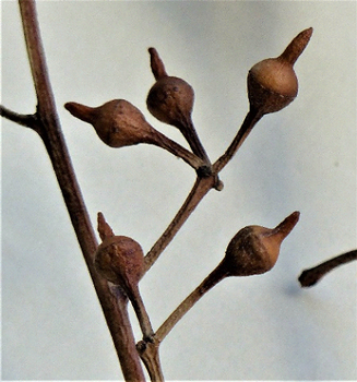
Given that Eucalypts do not have petals and sepals as such, it is features of the flower bud and fruits that become useful when identifying species. Pre-flowering buds in Eucalypts have a wide range in their shape and width, and depending on species they may be formed singly or in clusters at the tip of branches or arise in the axis between the leaf stalk and the stem. The shape of the flower bud cap, the operculum, also serves as a good feature when identifying Eucalypt species. For those who are familiar author May Gibbs will remember that the gum nut babies wore Eucalypt operculums and their hats.

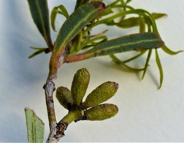
Eucalypt bud cluster originally with 7 buds. Each bud is spindle shaped with a stalk
that is very short of absent and has a warty surface texture. The fine operculum
suture line maybe distinguished about 1/3 the way from the tip of the bud.

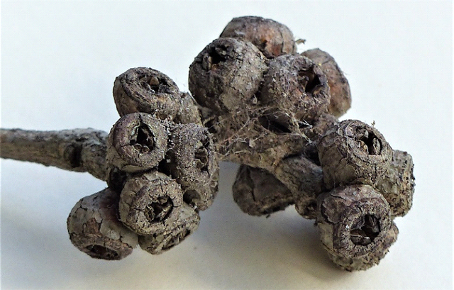
Post-flowering the operculum falls away, the stamens and stigma wither, and it is features of the remaining capsule that become valuable in distinguishing species. The mature capsule is the fruit of eucalypts. There is clearly variation in capsule shape and in some species the disc (the scar left by the fallen stamens) on the capsule rim may be ascending or otherwise. The valves are teeth-like structures that control the release of seed from inside the fruit. The valves vary in number and depending on species the valves may be enclosed well inside the capsule or exserted.

Clusters of mature Eucalypt fruits. Each appears to be stalkless, hemispherical in
shape with an ascending disc (to which the stamens were attached), the thin scar left
by the operculum outside this and three, near-level valves.

E. camaldulensis, river red gum has stalked buds arise from the axis of leaves, in groups of 7 to 11 in number and have a beaked operculum. The fruits are small 0.3x1cm, the disc is ascending and the valves are exserted. Distinguishing features of E. miniata, the Darwin wollybutt, beside its brilliant orange flowers are its large ribbed fruits, without stalks, that measure 6x5cm with deeply enclosed valves.

The beaked operculum of
E. camaldulensis, river red gum buds

E. platyphylla Horn Island, Torres Straight QLD.

Regeneration

Fire is a fairly common feature in most natural Australian environments and Eucalypts have adaptive mechanisms to respond to this destructive natural force. With mallee species the lignotuber is the source of canopy regeneration following fire. Multiple shoots sprout up from the lignotuber and a few of these survive to form new trunks and branches to re-establish the burnt plant. In many other Eucalypts like the gums, stringy barks and iron barks, buds lying under the bark (called epicormic buds) are stimulated following defoliation by fire and their growth produces branches and leaves to replace the canopy.

Two species, alpine ash (E. delegatensis) and mountain ash (E. regnans) form large areas of the Victorian forests and they are examples of Eucalypts that regenerate from seed. Fire in forests of alpine and mountain ash not only clears the ground surface but stimulates mature trees to shed their seed. The dropped seed germinates in the fire ash and after 80 to 100 years trees reach maturity. As a matter of interest mountain ash is the tallest growing hardwood with trees over 100 metres high and one recorded at 132 metres. The karri (E. diversicolor) in Western Australia runs a close second to the mountain ash. These and other large (in height and girth) old trees may live for several 100 years and hollows in their trunks are ideal habitats for possums and birds.

A few of the Eucalypt species from northern Australia are deciduous and loose a large proportion of their leaves during the dry season. Regeneration is evident during the build-up prior to the wet season onset. E.platyphylla, the poplar gum, is a species that is often deciduous during the dry season.

Mungo National Park in the Willandra Lakes Regional World Heritage Area – Background briefing on landscapes and human history

b39
Lake Mungo floor with the lunette on the north and east side in the background. Mungo National Park

Lake Mungo and its past inhabitants

It is hard to appreciate when driving across the bed of Lake Mungo in semi-arid, southwestern New South Wales that this used to be up to 15 metre deep freshwater and spread over 200 square kilometre with an environment that provided favourable living conditions for the predecessors of the three local Aboriginal ‘tribes’. The Barkindji (Parkantiji), Nylampaa (Nglyampee), and Mutthi claim Willandra Lakes, including Lake Mungo, as their Traditional Land and meeting place.

Geomorphologists and climate scientists tell us that these lake-full conditions occurred before the last ice age during the period 50,000 ya to 25,000 ya when water was carried to Lake Mungo and the other local dry lakes, by Willandra Creek. About this time there had been a rise in the uplands of eastern Australia and a sinking of land in westward crossed by the Lachlan, Murrumbidgee and Murray rivers and their vast riverine plain. Like the other two rivers, the Lachlan River is/was fed by tributaries from the high country in eastern New South Wales.

A response of rivers flowing over flat riverine plains is the development of anabranches (river offshoot channels), long waterholes and billabongs. In the past Willandra Creek was the longest but not the only Lachlan River off-shoot and behaved as a river anabranch that flowed via the Willandra Lakes, including Lake Mungo, and eventually discharged into the Murray River. Today this creek is still a branch off the Lachlan River but only carries water short distances when the river floods.

The warm wet pre ice age period favoured a wide variety of plant growth, not the arid-adapted species we see today, and consequently there was a wide range of animals for food both on land and in the water for human consumption. Food sources would have included plant products like fruits, seeds, leaf and tubers and those from animals such as kangaroo, emu, reptiles, water birds and fish, and the collection of birds eggs, crayfish and mussels.

Map of the Willandra Lakes Region showing the World Heritage Area
Boundaries. Lake Mungo is in the middle of the chain of lakes.
From Wikipedia, 2020

Following assessment of many different date-measuring techniques (eg radio-carbon dating and optically stimulated luminescence (OSL)) from this burial site, a multi-disciplinary committee of archaeologists, national park personnel and indigenous Australians has assessed the male body to be older than that of the cremated female. In 2015, following requests from the Mungo National Park Traditional Owners, the skeletal remains were locked away and stored at the National Museum and in 2017 they returned to Lake Mungo for reburial.
Visitors to Mungo National Park see other evidence of past Aboriginal occupation by Indigenous guides including stone tools, hearth sites, middens and to hear about cultural practices. It is also possible to visit the woolshed and see other remains of the rural properties Mungo and Zanci that once operated here. Inside the Interpretation Centre visitors can also read about the history of the park including the gigantic Zygomaturus. This is an herbivorous megafauna species that grazed around the Willandra Lakes and became extinct about 33,000 to 37,000 ya.

Group with Aboriginal guide in Lake Mungo National Park inspecting an ancient camp site hearths and stone tools.

However, lake levels started to drop by 40,000 ya, with increasing fluctuation in their levels, and by the time the last ice age reached its maximum, 22,000 – 18,000 ya, the freshwater flows had stopped and the average temperatures had dropped by 6 -9 Celsius degrees. Willandra Lakes had dried up and in so doing had accumulated gypsum, crystallised from the evaporated water, on their surfaces and their Aboriginal population had dispersed.

Most of the evidence for human occupation in the Lake Mungo area is derived from artifacts and burial sites that date from the period 50,000 – 25,000 ya prior to the recent ice age, with one major exception. In 2003 there was the discover of many 100s of footprints along 25 individual tracks in mud that was dated from 20,000 ya. These have been rated as Australia’s oldest and only Pleistocene footprints. While most of the prints were human there were some marsupial and emu tracks in the mix.

In 1969 Jim Bowler, a geomorphologist from University of Melbourne, had been studying the crescent shaped dune (a lunette) found on the north and eastern shore of Lake Mungo and chanced upon human skeletal remains exposed by dune erosion. The cremated crushed bones were those of a female. This ceremonial burial took place about 42,000 ya and, to date, this is the oldest cremation known. In 1974 Jim also found the grave site of a man also revealed by wind erosion of the dune. This body had been buried with his arms crossed and covered with red ochre, which was assessed as a ceremonial material that had been sourced from 200 km away.

The Fascinating Lunette

The largest and most prominent feature in the National Park is connected to the eroding lunette on the north eastern side of the lakebed. Lunettes are crescent shaped sand dunes formed on the edge of lake and like most dunes result from the accumulation of wind-blown sediments. Prior to the introduction of rabbits and sheep the lunette maintained its natural vegetation cover and its original shape.

Beginning in 1864, stock grazing began denuding the area and there was the added problem of plant destruction and soil disturbance by rabbits that opened the lunette to wind and water erosion. Today feral goats accentuate the problems of the past. The eventual exposure of the lunette by erosion has revealed its make-up and its various layers as distinguished by the colour, soil texture and position of the remaining sediments.

Recent eroded sand advancing over the lunette in a north easterly direction

Eroded lunette with patch of the Gol Gol unit (foreground) and larger mounds of the Mungo unit.

The Lake Mungo lunette was shaped by south-westerly winds and originally, there was a continuous 24 km long, 20 m high ridge capping most of the lunette. Geomorphological and archaeological studies have determined that the lunette was formed on this eastern and north east side of the lake in three main phases following a full lake some 40,000 ya. In low water periods red dust from the plains mixed with beach sand from the lake which accumulated as low, wind-blown dunes that were stabilised by reed and other natural vegetation when it refilled. However as low water periods became more common after 35,000 ya, the persistent winds sweeping across the exposed floor of the lake were able to pick up dried clay and sand and deposited these above the red sands. This created brownish-grey sandy layers and as they accumulated were stabilised by vegetation.

As good seasons returned water levels rose again but more layers were added during the next low water period.
Geomorphologists named the red sand layer the Gol Gol Unit after one of the oldest local stations and the much thicker brownish-grey sandy layer above it the Mungo Unit.

These two layers are of most interest to archaeologists given that their formations coincided with the most affable period for human life around the lake. They extend some 200 m from the lake side to the outer edge of the lunette. The final stages of lake drying began 22,000 ya and by 19,000 ya the lake floor was bare and had accumulated gypsum. Dust of clay and gypsum from the lake began to be deposited as the upper layer of the dune. This is referred to as the Zanci Unit. The striking landform features resulting from erosion of this Unit and those below have been called The Walls of China.
Justification for this area to be classified as a UNESCO World Heritage site is based on three criteria as summarised by the Mungo National Park website. Two are based on natural features, the other of cultural history:

‘Natural: as an outstanding example representing the major stages in the Earth’s evolutionary history; and as an outstanding example representing significant ongoing geological processes. Cultural: bearing an exceptional testimony to a past civilisation.’

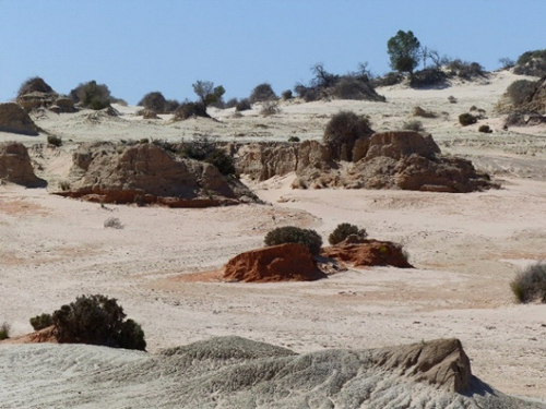
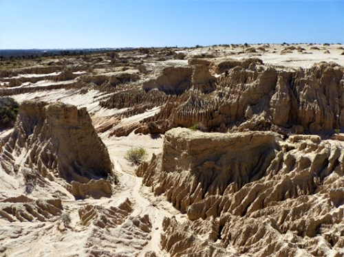
Water erosion and The Walls of China. Lake Mungo

Lake Condah and Budj Bim Cultural Landscape – Background briefing on landscapes and human history

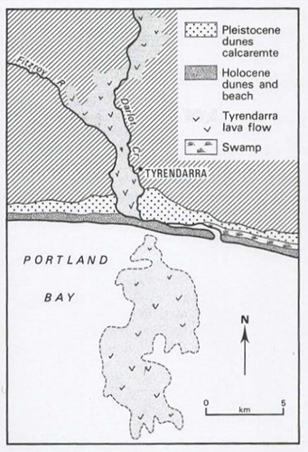
The Tyrendarra lava flow from Budj Bim covered land to its west and formed a long narrow 18km flow southward.
Currently it seems to end at the sea shoreline of Portland Bay but in fact the flow continued, during a period of low sea level, into the current Bay area for a further 15 km.
Lake Condah is situated in south western Victoria, south of Hamilton and north east of Portland and Hayward. The is known by the Gunditjmara people, the traditional owners or this area, as Tae Rak.
Interestingly the eruption of Mt Eccles in the northeast of this Cultural Landscape is recorded as a significant element in the traditional creation stories of the Gunditjmara, telling of the origin of their culture. and the mountain is given the traditional name of their creator Budj Bim.

The molten basalt of the Tyrendarra lava flow from Budj Bim (Mt Eccles) came from an eruption 36,900 +/- 3,100 years ago (ya). This was not its only eruption and the last occurred some 6,500 ya. Today Lake Surprise fills the craters of the now extinct volcano.

IMGP6810
Lake Surprise now fills three of the four craters of Mt Eccles, Western Victoria.

It is thought that the Lake Condah was formed by a wall of basalt that blocked off the natural drainage. Peat from the base of Lake Condah swamp has been dated at just over 6,000 (ya) a which gives an indication of when the lake may have formed.

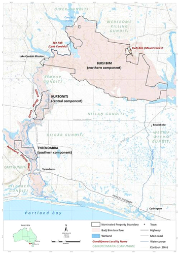
The World Heritage site, Budj Bim Cultural Landscape is divided into three components all based on rock from the initial Tyrendarra flow. Lake Condah, Darlot Creek, Budj Bim (Mt. Eccles) and the broad section of the Tyrendarra lava flow are contained in the northern component. The central component of this divided Cultural Landscape, Kurtonitj, also on the flow which is bordered on each side by the Fitzroy River on its west and Darlot Creek on the east. The southern component, named Tyrendarra, also has a north-south orientation. It is east of Tyrendarra township and contains the basalt and the wetlands between the river and the creek.

In response to the autumn and winter rains the basalt surface has produced a landscape with swamps, wetlands and low-lying land prone to flooding on each of the three Cultural Landscape components. These provide an ideal habitat for Kooyang, the short-finned eel, a fish that featured prominently in the lives of the Gunditjmara people for some 6 000 years.

The southern section of the Tyrendarra lava flow
on land and under Portland Bay
(adapted from E.C. Bird, The Coast of Victoria. MUP, 1993)

Location map showing Lake Condah, sections of
Budj Bim World Heritage site in southwestern Victoria
with their relationship to Darlot Creek and in the south-west to the Fitzroy River.
(adapted from the UNESCO via Creative Commons Licenses)

Elvers (juvenile eels) from the Southern Ocean move up the local streams like Darlot Creek then spread out to the wetlands where they mature into adult eels. The elvers may cross moist land surfaces to reach their destination where they live until they reach sexual maturity. Between the age of 15 and 30 years when the females reach maturity they are about a metre long; males are slower growing and smaller reaching maturity when 14 years old. At this stage these adults return to the salt water and migrate from the Southern Ocean to tropical locations like the Coral Sea off New Caledonia to mate and produce the next generation.

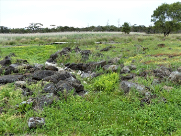
It is mainly at this mature size that the Gunditijmara would have caught the animals in an elaborate system built using waterways they have dug and barriers they have built from basalt stones as part of their cultural landscape.

The barriers were fitted with platted tubular, tapered pot/trap and most trapping was during autumn as the adult eels begin their migration. The eels were caught as they emerged from the end of the pot, killed with a bite to the back of their head then used as fresh food or smoked as a means of preservation. Smoking was carried out by hanging the eels over smoky fires in the hollows of large eucalypt trees.

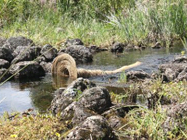
Ovegrown channel and built barrier.
Repaired barrier with eel pot. Tyrendarra.

The earthworks and built channels connected swamps allowing water movement in both directions. In similar ‘engineering’ at nearby Toolondo, channels up to 2.5 km were constructed to also join swamps and archaeologist Harry Lourandos calculated that 13,000 hours of labour would have been involved in the project. While several of the local engineering works may have begun in the order of 6,000 ya, it is suggested that the system at Lake Condah may be more recent than this.
Other Gunditjmara built structures in this region were the many horse-shoe shaped dry stone walls shelters using the basalt boulders. These foundations had relatively shallow walls and most were 2-3 m in diameter though some, at 4 m-5 m, would have been capable of housing eleven people.

Archaeologist Josephine Flood suggests these shelters provided temporary housing and were roofed with sticks and sheets of bark but that describing the aggregation of these structures as ‘villages of stone houses’, as suggested by some authors, is an exaggeration [see The Original Australians. A&U, 2006]. The shelters served a purpose when the eels were being harvested but the clan groups and families moved to other sections of their country in outside the eeling season.

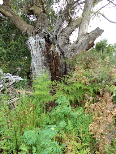
Remains of an aged eucalypt with the hollowed-out trumk that
had been used for smoking eels. Tyrendarra

Replica house built on one of the many shelter foundations found in Budj Bim

As a World heritage Area it is the most recently declared World Heritage site being Australia’s 20th and officially recognised by the UNESCO committee on 6th July 2019. The decision was based on the following main criterion that make it the only Australian World Heritage sites to be based only on cultural heritage.

Criterion (iii)
Gunditjmara knowledge and practices have endured and continue to be passed down through their Elders and are recognisable across the wetlands of the Budj Bim Cultural Landscape in the form of ancient and elaborate systems of stone-walled kooyang [eel] husbandry (or aquaculture) facilities.

Criterion (v)
The continuing cultural landscape of the Budj Bim Cultural Landscape is an outstanding representative example of human interaction with the environment and testimony to the lives of the Gunditjmara.

Naracoorte Caves, South Australia – Background briefing on landscape and natural history

A megastore of mammal fossils in south eastern South Australia at Naracoorte

Naracoorte is in south eastern South Australia in a state region called The Limestone Coast. This region has many coastal attractions including the recent evidence of volcanic activity and limestone formations at Mount Gambier, a beautiful coastline, wine producing areas with the most famous vineyards based on a narrow (15 km x 2 km) strip of limestone derived Terra Rossa soils and the Naracoorte Caves. In the Naracoorte Cave area there are some 25 caves, several of which are open to the public.

Caves like those near Naracoorte can only develop on limestone. Locally this limestone is derived from two adjacent sources of marine sediments broadly termed the Gambier Limestone and the Calcarenite dunes. The first of these is the oldest, being formed in the Tertiary Period, from about 37 to 12 million year ago. Cave formation has been most active in this limestone. The limestone dominated dunes that made the Calcarenite are from the Pleistocene Epoch (2.6 million to 10,000 ya (years ago) within the more recent Quaternary Period and these overly the cave area with their limestone (Calcarenite) helping preserve the integrity of the caves beneath. However, in some places, solution tubes have penetrated the Calcarenite and these have become the pitfall traps as described below. All this area along with the limestones has been subject to uplift about 800,000 ya and Naracoorte is about 50m above sea level.
Limestone is subject to weathering via weak acid such as that formed when carbon dioxide naturally dissolves in water or when weak organic acids from decaying vegetation moves through the soil and into the joints of the underlying limestone rock.

Terra Rossa soil profile with the limestone subsoil in the famous Coonawara wine growing area. South Australia
Attractive coastal scenery at Beachport dominated by limestone calcarenite rocks.
The Umpherston sinkhole in Mt Gambier. The Mt. Gambier Limestone a formation also occurs at Naracoorte.
Over long periods chemical weathering develops cave systems, with passages and caverns as the solid Calcium Carbonate limestone undergoes dissolution (i.e. the limestone going into solution) and is then removed via underground streams. While the emphasis in this article is on fossils, we must not forget the attractiveness of dripstone formations that develop in limestone caves when carbon dioxide is diffused into the atmosphere from the solution resulting is the precipitation of Calcium Carbonate crystals which en masse form wonderful formations like stalagmites, stalactites, ribbon, shawls and flowstone.

The roof of caves may be penetrated by what are referred to as a sink-hole or doline and when large enough these not only allow runoff water to carry surface sediments underground but become pit-fall traps for animals. While some animals suffering such a fall may be injured or die, others trapped deep underground have died from starvation then adding their decaying bodies to the growing hills of sediments falling from the sink-hole above to become fossils. Sink-holes in the Naracoorte cave area have been recipients of such fossils for over 500,000 years.
A rich find was made in the late 1960s when two underground cave explorers squeezed through a passage leading from Victoria Cave. Victoria Cave has a depth of 20 m and is made up of several collapsed caverns and some 3 km of surveyed interlinking crawl ways or passages. The explorers discovered a previously un-known cavern and found it to be filled with mountains of red sediment and countless jaws and skulls of previous lost megafauna. The particular sink-hole that had produced the build-up had been blocked off about 15,000 ya, but Fossil Cavern/ Chamber, as it was then named by palaeontologists, had been collecting skeletons for over 200,000 years before the closure. In places fossils are found in 3 to 4 m deep sediments.

Megafauna are in many cases oversized species related to many of today’s fauna. Australian megafauna includes the giant short-faced kangaroos, the giant monitor lizard and the Diprotodon, Zygomaturus that looked like a giant wombat. As well, a marsupial lion (Thylacoleo carnifex) was found and added to a previously discovered family of extinct carnivorous marsupials. Palaeontologists were able to reconstruct much of the marsupial lion’s skeleton but were missing the hind limbs. As luck would have it, workers at a nearby Naracoorte limestone quarry came across a cavern littered with many fossils during their operations. Work stopped in this section and a recovery team of palaeontologists documented and collected all the fossilised material found in the cavern. Among the specimens recovered were some vertebrae and the hind leg of Thylacoleo carnifex!

Mounds of sediments and fossils. Fossil Cavern Victoria Cave, Naracoorte. Wikipedia.

The fossil finds at Naracoorte were scientifically significant enough for the area to be accepted and listed as a World Heritage site. While these fossils account for the animals that existed during and prior to the arrival of Aboriginal people, particularly the Australian megafauna, fossils found Riversleigh in NW Queensland had mostly formed well before Aboriginal arrival. Up to 1986 early studies found fossils at 30 different sites and these ranged in age from existing 50,000ya to 15 Mya (million years ago): in geological terms from the Pleistocene back to the mid Miocene epochs. However, by 2011 on-going research reported fossil material from 25 Mya, in the Oligocene epoch, and in 2012 fossils had been found in 200 Riversleigh locations. The richest of these sites yielded 35 fossil bat species and another important discovery were Monotreme fossils representing the primordial platypus.

The Australian megafauna become extinct between 60,000 and 40,000 ya and there is considerable debate about what caused their demise. Two major arguments put forward are firstly that the environment was getting drier through climate change so changing the kind of food available to the megafauna. The other argument is that Aboriginal people, the first humans to occupy the country, were changing the environment mainly through burning practices to manage their country and hunting. Of course, megafauna extinction does not have to be one or the other of these factors and it is likely that both climate change and the Aboriginal practices contributed but not necessarily in equal proportions.

Marsupial Lion skeleton on display in Victoria Cave, Narracoorte

A giant short-faced kangaroo in a diorama, Naracoorte Caves visitor centre

Many of the other animal fossils species were from groups similar to those being found at Naracoorte, but the majority had been living in much wetter environments that supported rainforest and wet sclerophyll forests and the majority had been preserved in limey mud in the bottom of pools. Unlike Narracoorte, the majority of Riversleigh fossils are from the mid Miocene and with exception of protruding bones are mostly ‘entombed’ in limestone rock originating from the limey mud. Before the fossils may be fully exposed the lumps of rock containing them are treated in a weak acetic acid bath to remove the limestone and so release to delicate fossil bones.
In the early days Riversleigh fossil site stood alone but it has now been enclosed within the nearby Lawn Hill National Park and the whole area is now called Boodjamulla National Park. Together Riversleigh and Narracoorte fossil sites have provided palaeontologists and zoologists with a lot of information particularly about the evolution of Mammals and because of their significance were co-listed as a World Heritage Sites in 1994 as Australian Fossil Mammal Sites (Riversleigh / Naracoorte).

Fossil bones and the gizzard stones of a bird embedded in limestone from Riversleigh
Limestone rocks at Riversleigh, the other part of the World Heritage site.